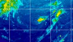
Current Radar or Satellite Image

Flhurricane.com - Central Florida Hurricane Center - Tracking Storms since 199531 Years of Hurricanes Without the Hype - Since 1995


Non-tropical Invest 94L well south of Bermuda slight odds of being named. EPAC TROF now extending across Central America into NW Caribbean.
Days since last Hurricane Landfall — US Any: 33 (Isaias), US Major: 763 (Milton), FL Any: 33 (Isaias), FL Major: 763 (Milton)
FlHurricane Atlantic Tropical Cyclone Tracking 🌀 Since 1995
HypeScale:
1.20
0510
Communication
Storm Data
Content
Follow & Connect


General Discussion >> The Tropics Today

doug
Weather Analyst


Reged:
Posts: 1006
Loc: parrish,fl
Re: Potential Next Invest
      Fri Jun 07 2013 10:23 AM

There is a convective area lingering over the Yucatan that seems detached from the tail of Andrea...might this also be a potential area for more activity?

--------------------
doug

Post Extras Print Post   Remind Me!     Notify Moderator


Entire topic
Subject Posted by Posted on
* Invest 92L cieldumortModerator Fri Jun 07 2013 10:23 AM
. * * Re: Potential Next Invest MikeCAdministrator   Thu Jun 06 2013 04:33 PM
. * * Re: Potential Next Invest doug   Fri Jun 07 2013 10:23 AM
. * * Re: Potential Next Invest Ed DunhamAdministrator   Thu Jun 06 2013 02:04 PM

Extra information
0 registered and 0 anonymous users are browsing this forum.

Moderator:  CFHC, MikeC, Ed Dunham, Colleen A., danielw, Clark, RedingtonBeachGuy, SkeetoBite, Bloodstar, tpratch, typhoon_tip, cieldumort 


Forum Permissions
      You cannot start new topics
      You cannot reply to topics
      HTML is disabled
      UBBCode is enabled

Rating:
Thread views: 5111

Rate this thread

Jump to