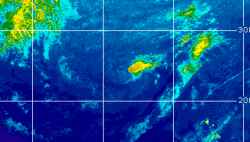
Current Radar or Satellite Image

Flhurricane.com - Central Florida Hurricane Center - Tracking Storms since 199531 Years of Hurricanes Without the Hype - Since 1995


Subropical to Tropical development becoming more likely over the weekend into next week off the southeast to east coast. Could head inland.
Days since last Hurricane Landfall — US Any: 40 (Isaias), US Major: 770 (Milton), FL Any: 40 (Isaias), FL Major: 770 (Milton)
FlHurricane Atlantic Tropical Cyclone Tracking 🌀 Since 1995
None
HypeScale:
0.66
0510
Communication
Storm Data
Content
Follow & Connect


General Discussion >> Other Storm Basins

Ed DunhamAdministrator
Former Meteorologist & CFHC Forum Moderator (Ed Passed Away on May 14, 2017)


Reged:
Posts: 2565
Loc: Melbourne, FL
Re: Central Pacific: TS Ana to approach Hawai'i
      Fri Oct 17 2014 09:34 AM

AF Recon flew over to Hawaii last night and investigated Ana enroute. Winds are now sustained at 70mph and Ana still has a chance to become a hurricane later today.
ED

Hawaii Satellite Image

Post Extras Print Post   Remind Me!     Notify Moderator


Entire topic
Subject Posted by Posted on
* Central Pacific: TS Ana to approach Hawai'i Stork Fri Oct 17 2014 09:34 AM
. * * Re: Central Pacific: TS Ana to approach Hawai'i Ed DunhamAdministrator   Thu Oct 16 2014 07:13 AM
. * * Re: Central Pacific: TS Ana to approach Hawai'i Ed DunhamAdministrator   Fri Oct 17 2014 09:34 AM
. * * Re: Central Pacific: TS Ana to approach Hawai'i vpbob21   Tue Oct 14 2014 06:18 PM
. * * Hawaiian Islands Due for Hurricane Rendezvous CoconutCandy   Wed Oct 15 2014 05:14 PM

Extra information
0 registered and 0 anonymous users are browsing this forum.

Moderator:  CFHC, Ed Dunham, Colleen A., danielw, Clark, RedingtonBeachGuy, SkeetoBite, Bloodstar, tpratch, typhoon_tip, cieldumort 


Forum Permissions
      You cannot start new topics
      You cannot reply to topics
      HTML is disabled
      UBBCode is enabled

Rating:
Thread views: 8521

Rate this thread

Jump to