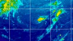
Current Radar or Satellite Image

Flhurricane.com - Central Florida Hurricane Center - Tracking Storms since 199531 Years of Hurricanes Without the Hype - Since 1995


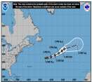
Josephine forms from 93L. Forecast to become a hurricane-force fish spinner. Watching off SE for potential new Area of Interest this weekend.
Days since last Hurricane Landfall — US Any: 14 (Isaias), US Major: 744 (Milton), FL Any: 14 (Isaias), FL Major: 744 (Milton)
FlHurricane Atlantic Tropical Cyclone Tracking 🌀 Since 1995
39.2N 67.3W
Wind: 65MPH
Pres: 988mb
Moving:
Present movement...ne or 45 degrees at 12 mph...19 km/h
Click for Storm Spotlight
HypeScale:
0.05
0510
Communication
Storm Data
Content
Follow & Connect
 

Position History For Subtropical Depression TWENTY-TWO (2005)

[ Other Storms] - [ Google Map of this Storm] [ xml ] [ csv ] [ json ]
Adv#DateLatLongWindPresMovementTypeNameReceivedForecaster
110/08 11:00 AM28.1N59.0W35MPH1009mbNorthwest near 15 MPHsubTDTWENTY-TWO10/08 10:40 AMBeven
1A10/08 2:00 PM28.6N59.9W35MPH1009mbWest-northwest near 15 MPHsubTDTWENTY-TWO10/08 1:40 PMBeven
210/08 5:00 PM29.1N60.8W35MPH1009mbWest-northwest near 20 MPHsubTDTWENTY-TWO10/08 4:43 PMBeven
2A10/08 8:00 PM29.2N62.0W35MPH1009mbWest near 20 MPHsubTDTWENTY-TWO10/08 8:03 PMKnabb/lauer
310/08 11:00 PM29.2N62.6W30MPH1010mbWest near 14 MPHsubTDTWENTY-TWO10/08 10:52 PMKnabb
flhurricane.com