cieldumort
Moderator

Reged:
Posts: 2932
Loc: Austin, Tx
|
|
5:00M EDT 8 October, 2026 Update
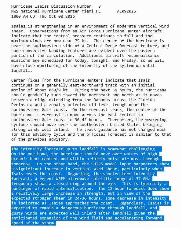
Isaias is now a 100 MPH Cat 2 Hurricane. 91% of the high-quality Google DeepMind WNv3 ensembles take the cyclone to Major status, understandably, as a solid inner core has formed and the cyclone is traveling over the very deep loop current heading into night. Those in the Warned areas should have completed preparations to protect life and property or be just about done. Substantial life-threatening conditions possible in the north-central to northeast Gulf Coast and points inland are becoming more likely than not starting as soon as Friday afternoon or evening.
Ciel
11:45AM EDT 8 October, 2026 Update
Isaias is well on its way to becoming a Category 2 hurricane with a run for Major. While there are many indications that shear will induce a weakening trend from somewhat before to during landfall, this trend will almost certainly come too late to prevent significant, dangerous, even life-threatening impacts from surge, wind, flooding rain and tornadoes. Preparations to protect life and property within the warned areas should now be getting rushed to completion.
Ciel
11:45PM EDT 7 October, 2026 Update
Isaias has broken the 2026 Atlantic hurricane drought tonight and is now the first tropical cyclone in the basin to receive the title.
NEW WARNINGS
*HURRICANE WARNING from Ocean Springs, MS. to Bay/Gulf Co line in Florida
*STORM SURGE WARNING from the mouth of the Mississippi River to the Steinhatchee River, Florida
*TROPICAL STORM WARNING from Jefferson/Plaquemines Parish line, LA to west of Ocean Springs, MS
*TROPICAL STORM WARNING from east of Bay/Gulf Co line to Aucilla River, FL
*TROPICAL STORM WARNING for the remainder of the old Hurricane Watch zone
Ciel
5:15PM EDT 7 October, 2026 Update
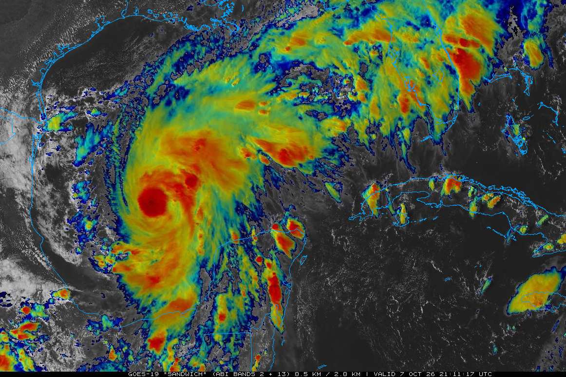
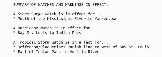
Isaias is now knocking on the door of becoming the first real-time hurricane of 2026. Hurricane and Tropical Storm Watches are expanding and Warnings will be coming very soon. The official forecast now calls for Isaias to peak out just below Cat 3 prior to a weakening trend heading into landfall, but not a weakening trend that would happen quickly enough to stave off serious, life-threatening impacts.
Ciel
3:00AM EDT 7 October, 2026 Update
NINE (from 92L) has become Tropical Storm Isaias. Hurricane Watches and Warnings are likely very soon. Storm Surge Watches and Warnings likely very soon.
Ciel
1:00AM EDT 7 October, 2026 Update
Models have ingested the first recon (upper air survey) mission's data and the 0z runs coming out are not providing any relief to hopes that those higher upper-bound intensity limits of future-Isaias were misguided. On the contrary, they confirmed them. Interests along the Gulf Coast from Louisiana to the Big Bend of Florida should begin paying very close attention to this fast developing situation. Hurricane Watches and Warnings could be coming soon and some right along the central to eastern Gulf may even be needing to consider evacuations if track and intensity guidance continues this trend.
Many more recon flights are scheduled for today. These missions will help pinpoint the specific locations along the coast most at risk heading into the weekend. In addition to the apparent increasing likelihood of sustained hurricane-force winds and substantial storm surge right along potions of the coast, owing to both the expected intensity and forward speed of this cyclone, locations well-inland may be facing a serious wind event. Coupled with heavy rain, scattered to widespread downed limbs, trees and even power lines are almost a given, if the current forecasts verify. Modeling also suggests that this system may spawn an unusually high number of waterspouts and/or tornadoes.
Ciel
4:30PM CDT 6 October, 2026 Update
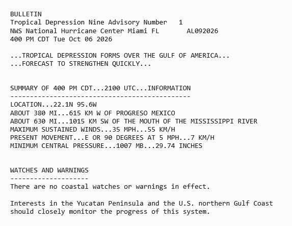
Invest 92L has become Tropical Depression NINE in the Bay of Campeche (SW Gulf). has issued the very first Advisory calling for intensity to reach Cat 2 on the Saffir-Simpson Scale, which would make then-Isaias the very first hurricane in the Atlantic basin this year. Interests along the north-central to northeastern Gulf Coast and points inland should begin paying close attention as Watches and/or Warnings could be going up at any time.
Ciel
Original Update
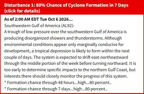
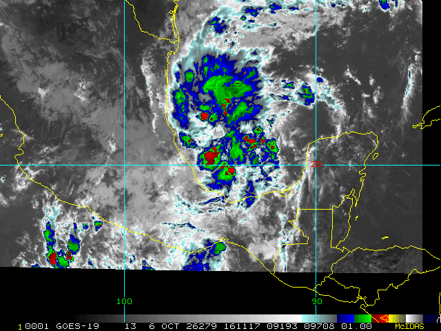
Above: Oct 6, 2026 2AM EDT Tropical Weather Update on 92L
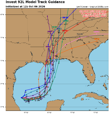
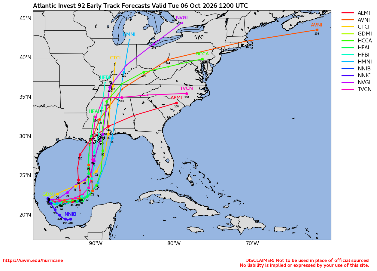
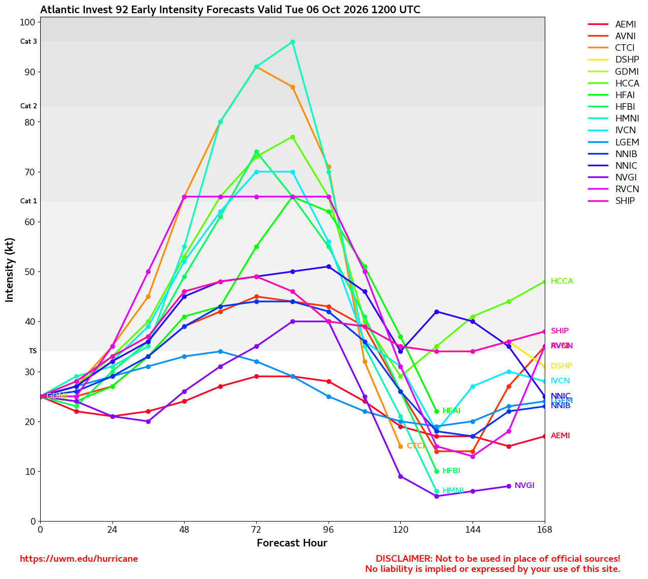
The Area of Interest we have been discussing for several days in the Forecast Lounge, now Invest 92L, has very robust, near unanimous model support for development, despite the presence of the strongest El Niño in recorded history. In reality, the next 48 to at most 72 hours is possibly crunch time for this system as if it doesn't get its act together by then, it may not have another window like this (just look at all the other Atlantic storms during the 2026 El Niño for reference).
92L is not yet a very well formed disturbance at all, and recon has not yet flown in. However, both could quickly change and in fact recon should be investigating 92L as soon as later today. Models strongly suggest that by then 92L should already have taken on more of a classic incipient tropical cyclone look, if not even be one. But, as notes in the above, at the moment it is still "too early to determine specific impacts to the northern Gulf Coast, but interests there should closely monitor the progress of this system." In non-NHC speak, Watches and Warnings could be going up along the northern Gulf Coast soon, just not as of 2AM EDT today.
Model deep-dives and analysis in the Isaias Forecast Lounge
|
cieldumort
Moderator
Reged:
Posts: 2932
Loc: Austin, Tx
|
|
|
cieldumort
Moderator
Reged:
Posts: 2932
Loc: Austin, Tx
|
|
|
|




 Previous
 Index
Index
 Next
Next
 Threaded


 Edit
Edit
 Reply
Reply
 Quote
Quote