cieldumort
Moderator

Reged:
Posts: 2738
Loc: Austin, Tx
|
|
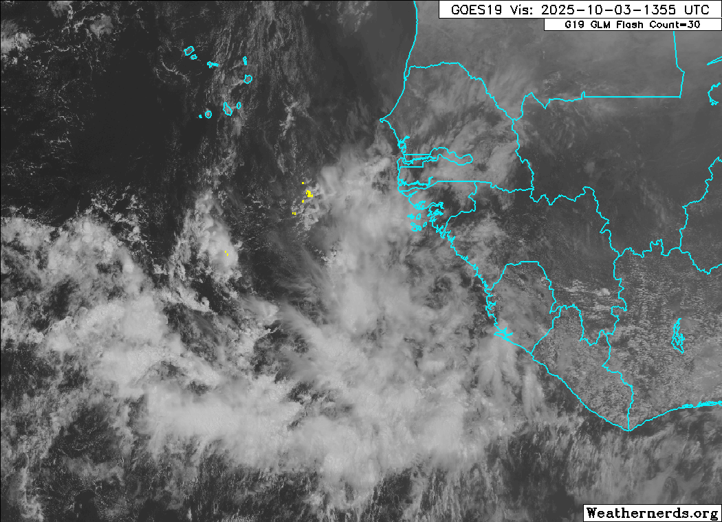
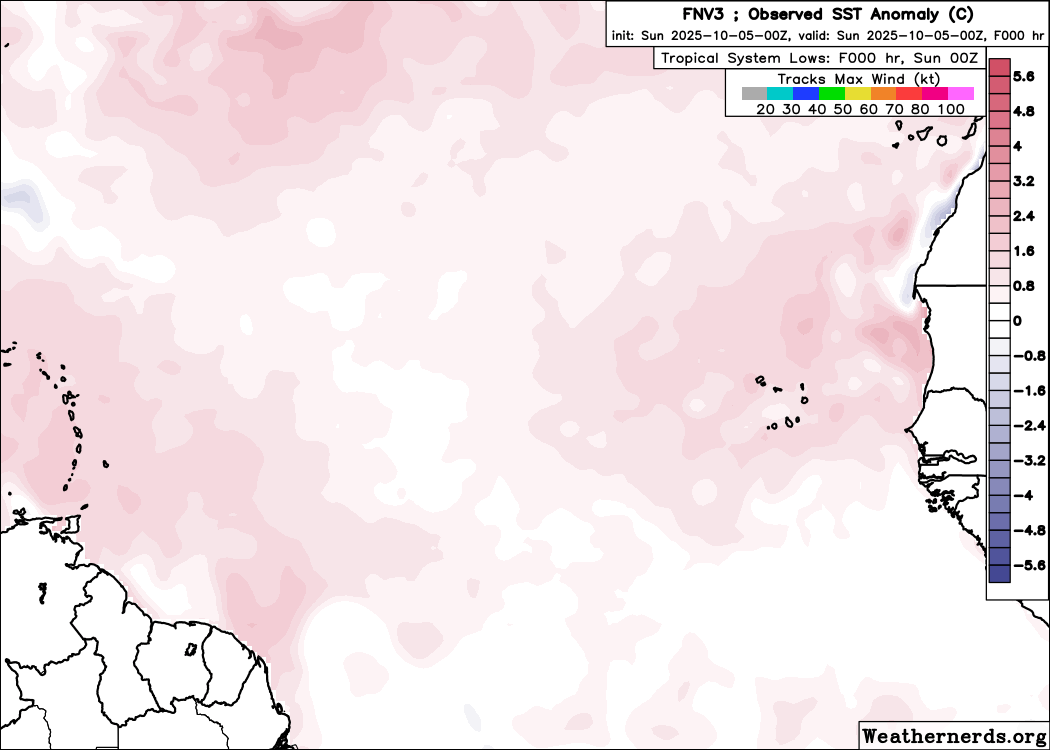
Operational models and ensembles, including the extraordinarily impressive Google AI ensembles, are very bullish on development of a wave about to exit western Africa into the far eastern Atlantic. Steering forecasts and trends further suggest a track that could take the system, developed into a TC or not, close to if not across the Lesser Antilles late in the runs. Considering the very strong signal for this feature, not yet an Invest but likely to be Invest tagged within 72-144 hours if forecasts begin verifying, we are opening a lounge for discussions of it at this time.
The wave in the far eastern Atlantic we have been tracking was Invest tagged overnight, 95L, and the title has been updated accordingly.
2025-10-05 06:00 8N 25.9W 25 KTS
This system has continued to become better organized and advisories are forthcoming for Tropical Storm Jerry on Oct 7th. The title has been updated accordingly.
2025-10-07 12:00 11.3N 43.8W 40 KTS
Ciel
Edited by cieldumort (Tue Oct 07 2025 09:56 AM)
|
cieldumort
Moderator
Reged:
Posts: 2738
Loc: Austin, Tx
|
|
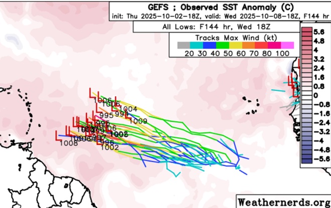
GFS Ensembles Initialized 10-2-25-18z run out to 144 hours
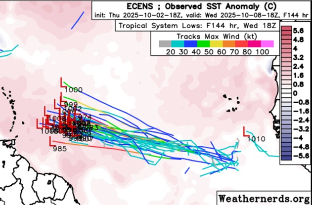
ECMWF Ensembles Initialized 10-2-25-18z run out to 144 hours
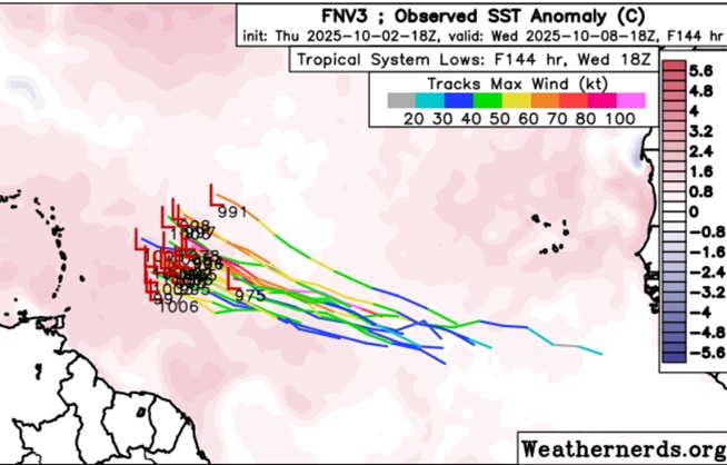
Google DeepMind Ensembles Initialized 10-2-25-18z run out to 144 hours
|
cieldumort
Moderator
Reged:
Posts: 2738
Loc: Austin, Tx
|
|
The anticipated robust wave has now entered the eastern Atlantic this morning. Conditions for development along its path are at least initially unencumbered by much shear or dry air, but instability may be below average, which has been status quo for much of the Tropical Atlantic this season. However, instability in this region increases heading into fall, and so is much more favorable now than even a month ago.
Given the above, it is conceivable that TC genesis occurs sooner rather than later, which could encourage a pull to the north prior to reaching the Antilles, but this is not a given. Most models hold off development until this system is at least half way to the longitude of the Lesser Antilles.
|
cieldumort
Moderator
Reged:
Posts: 2738
Loc: Austin, Tx
|
|
Today's 0z Google DeepMind ensembles continue to favor a track out to sea prior to reaching the Antilles, which looks most likely, especially given how well developed 95L already is.
|


 Threaded


