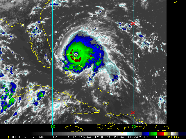
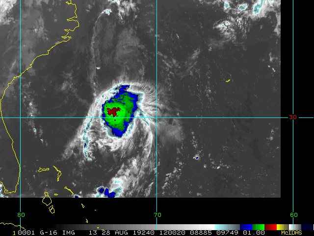
Current Radar or Satellite Image

Flhurricane.com - Central Florida Hurricane Center - Tracking Storms since 1995Hurricanes Without the Hype! Since 1995


Days since last H. Landfall - US: Any 86 (Milton) , Major: 86 (Milton) Florida - Any: 86 (Milton) Major: 86 (Milton)


Archives 2010s >> 2019 News Talkbacks

Pages: 1
cieldumort
Moderator


Reged:
Posts: 2497
Loc: Austin, Tx
Heading into Season Peak with Several Systems Close to Home
      #100053 - Fri Aug 23 2019 05:17 PM


5PM EST 24 August 2019 Update
FIVE has become a Tropical Storm, Dorian, the fourth named storm of the 2019 Atlantic Hurricane Season.

Dorian is traversing an environment characterized by moderate vertical wind shear and low mid-level humidities. However, shear is forecast to drop by midday Sunday, and remain low or even very low through Tuesday. As the well-defined TC crosses over warm waters while in this very favorable shear, the potential for dry air intrusions could be low, and in fact the official NHC forecast calls for Dorian to become a hurricane within 72 hours.

Key Messages:
Quote:

1. Dorian is forecast to strengthen and could be near hurricane strength when it approaches the Lesser Antilles on Tuesday.

2. It is too soon to determine the specific timing or magnitude of impacts in the Lesser Antilles, but tropical storm or hurricane watches may be needed for a portion of the area on Sunday.


Original Entry
We are just a few weeks away from the climatological peak of the Atlantic Hurricane Season, and there are several systems we are monitoring, three of which are close to or closing in on land: 98L, 99L, W Gulf Low (Very strong 90L candidate).

As these systems are all tending to form in the Western Atlantic, as has been a trend this year, they are far more likely to affect land or interests close to land, including the south and/or southeast U.S.

As of 5PM EDT today August 23, official NHC odds for development are as follows: 98L 90%, 99L 50% (could be conservative), Gulf Low: TBD. Was still under 10% at the 2PM TWO and thus not listed at that time, but this system has continued to impress, with surface pressures falling some and winds increasing some throughout the day today.

Follow along with us in the 2019 Forecast Lounge , as well as here on the Homepage.

Links to individual Forecast Lounges:
Invest 98L Lounge, Tropical Storm Dorian Lounge, W Gulf Low _90L_ Lounge


Invest 98L Lounge Invest 99L Lounge W Gulf Trof Lounge


Edited by MikeC (Sun Aug 25 2019 06:31 AM)


Post Extras: Print Post   Remind Me!   Notify Moderator  
lunkerhunter
Storm Tracker


Reged:
Posts: 248
Loc: Saint Augustine, FL
Re: Heading into Season Peak with Several Systems Close to Home [Re: cieldumort]
      #100058 - Sat Aug 24 2019 09:49 PM

Seems a lot of the Dorian and 98L graphics and links are mixed

Post Extras: Print Post   Remind Me!   Notify Moderator  
cieldumort
Moderator


Reged:
Posts: 2497
Loc: Austin, Tx
Re: Heading into Season Peak with Several Systems Close to Home [Re: lunkerhunter]
      #100059 - Sun Aug 25 2019 12:32 AM

Quote:

Seems a lot of the Dorian and 98L graphics and links are mixed


Indeed. It's on SFWMD's end, not ours. I've removed the links until they are corrected to prevent any confusion.


Post Extras: Print Post   Remind Me!   Notify Moderator  
MikeCAdministrator
Admin


Reged:
Posts: 4635
Loc: Orlando, FL
Re: Heading into Season Peak with Several Systems Close to Home [Re: cieldumort]
      #100067 - Sun Aug 25 2019 06:03 PM

recording Caribbean mosaic radar for Dorian http://flhurricane.com/imageanimator.php?460

Post Extras: Print Post   Remind Me!   Notify Moderator  
Pages: 1


Extra information
0 registered and 0 anonymous users are browsing this forum.

Moderator:  

Print Topic

Forum Permissions
      You cannot start new topics
      You cannot reply to topics
      HTML is disabled
      UBBCode is enabled

Rating:
Topic views: 11915

Rate this topic

Jump to

Note: This is NOT an official page. It is run by weather hobbyists and should not be used as a replacement for official sources. 
CFHC's main servers are currently located at
Hostdime.com in Orlando, FL.
Image Server Network thanks to Mike Potts and Amazon Web Services. If you have static file hosting space that allows dns aliasing contact us to help out! Some Maps Provided by:
Great thanks to all who donated and everyone who uses the site as well. Site designed for 800x600+ resolution
When in doubt, take the word of the National Hurricane Center