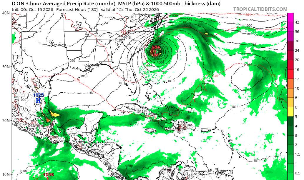
Given the pattern of fronts pushing into Florida on a weekly basis (but not yet scouring out moisture for more than a day or two), followed by high pressure setting up strong onshore flow across the peninsula, it would not be an "October surprise" to see models start to lock in on a hybrid system spinning up in the Atlantic east of Florida and north of the Abacos later in October. Several recent model runs hint at this.
Regardless of cyclogenesis, multi-day episodes of strong onshore winds, especially during the last week of the month when King tides peak, could be very impactful along Florida's east coast.
I was 26 living on a sailboat working at a county park just north of Sebastian Inlet... the analog storm still etched in my memory: Nov_1984_storm.pdf
The most recent ICON run (15/0z) which this model sometimes sniffs out future development where other models miss earlier on, is definitely on board with the general idea, albeit perhaps a bit further north.
So, remarkably, despite the headwinds coming out of the eastern Pacific, the overall state of the Atlantic basin is one I wouldn't write off the rest of this month. Gulf stream probably bears some monitoring.



 Previous
 Index
Index
 Next
Next
 Threaded




 Edit
Edit
 Reply
Reply
 Quote
Quote