Current Radar or Satellite Image

Flhurricane.com - Central Florida Hurricane Center - Tracking Storms since 199531 Years of Hurricanes Without the Hype - Since 1995


Monitoring Invest 93L off the east coast, likely fish storm, but still some coastal impacts (dangerous surf, costal flooding).
Days since last Hurricane Landfall — US Any: 10 (Isaias), US Major: 740 (Milton), FL Any: 10 (Isaias), FL Major: 740 (Milton)
FlHurricane Atlantic Tropical Cyclone Tracking 🌀 Since 1995
HypeScale:
1.45
0510
Communication
Storm Data
Content
Follow & Connect


General Discussion >> 2026 Forecast Lounge

Jump to first unread post. Pages: 1
cieldumortModerator
Moderator


Reged:
Posts: 2944
Loc: Austin, Tx
93L Lounge
      #116344 - Sat Oct 17 2026 06:39 PM

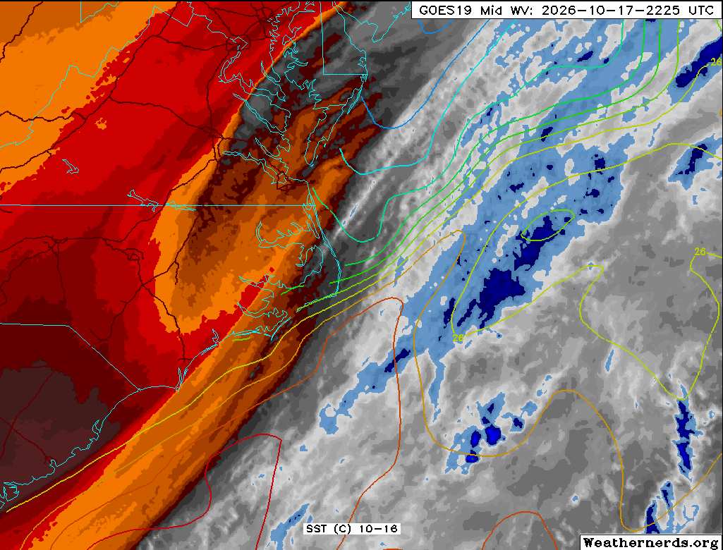
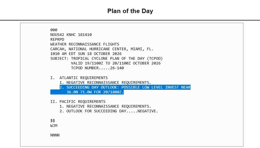
An overwhelming majority of all models and their ensembles are now forecasting the development of a strong or very strong non-tropical low near or over the Gulf Stream roughly east of North Carolina as soon as late Sunday. This region is now an official NHC 20% Area of Interest and given its potential to transition into a strong subtropical or even tropical cyclone and have significant coastal impacts regardless, we are starting a Lounge on this feature at this time, Invest TBD.


Above: Water Vapor image of precursor system 10-17-26-2225z. SST contours added. Image credit: Weathernerds.org

2026-10-19 18:00 33.8N 70.6W 45KTS
During the day on October 19, 2026, the non-tropical low pressure system we have been tracking was Invest-tagged, 93L, and the title has been updated accordingly.
Ciel

Edited by cieldumort (Mon Oct 19 2026 10:06 PM)


Post Extras: Print Post   Remind Me!   Notify Moderator  
cieldumortModerator
Moderator


Reged:
Posts: 2944
Loc: Austin, Tx
Re: Gulf Stream Coastal Low w Tropical Potential [Re: cieldumort]
      #116345 - Sat Oct 17 2026 06:46 PM

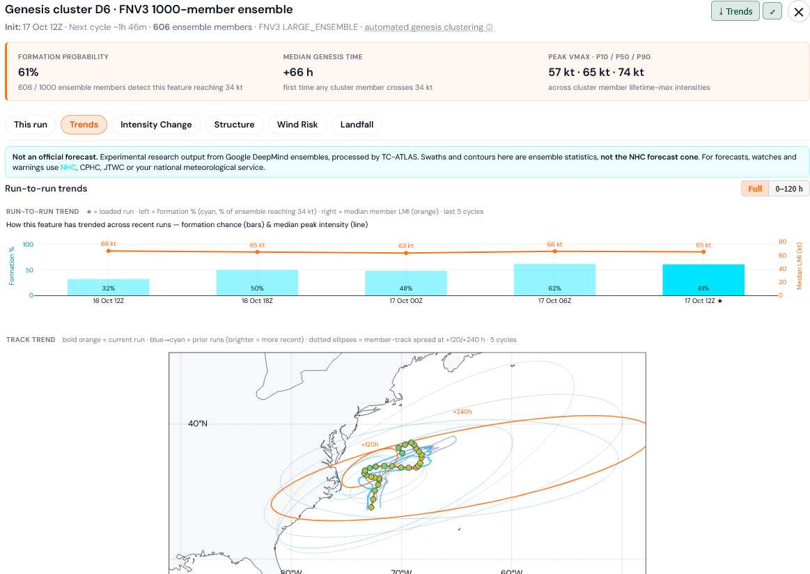
Today's most recent DeepMind FNv3 1000-member ensemble advertising a 61% chance of reaching 34+ knots


Image credit: TC-ATLAS


Post Extras: Print Post   Remind Me!   Notify Moderator  
cieldumortModerator
Moderator


Reged:
Posts: 2944
Loc: Austin, Tx
Re: Gulf Stream Coastal Low w Tropical Potential [Re: cieldumort]
      #116347 - Sun Oct 18 2026 03:30 PM


Post Extras: Print Post   Remind Me!   Notify Moderator  
cieldumortModerator
Moderator


Reged:
Posts: 2944
Loc: Austin, Tx
Re: 93L Lounge [Re: cieldumort]
      #116351 - Tue Oct 20 2026 01:41 AM


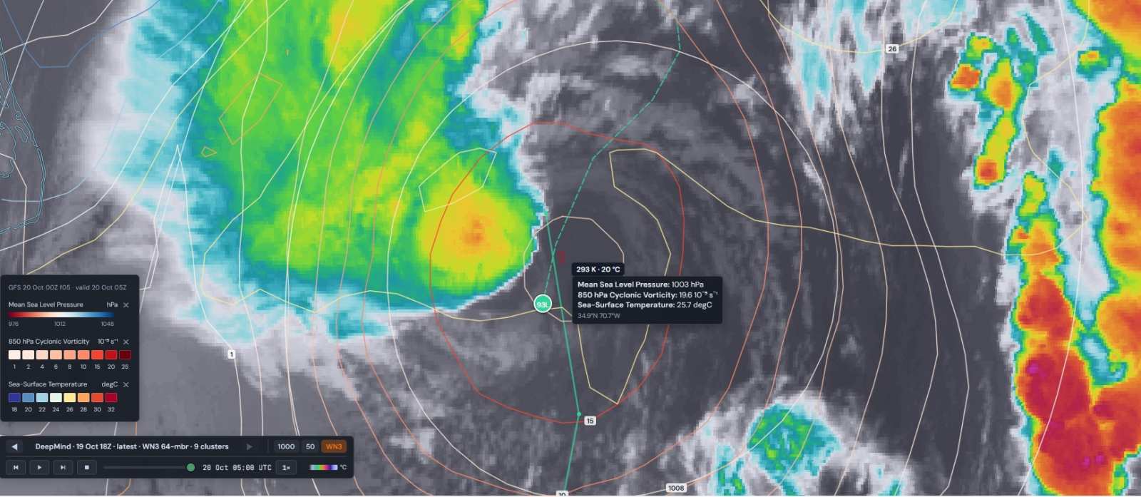
93L 10-20-26-05z MSLP 850 hPa Vorticity SST analysis overlay atop IR. Image credits: TC-ATLAS

The cyclone is trying, but relatively cool SSTs as well as some shear are clearly challenging the attempted transition, so far


Post Extras: Print Post   Remind Me!   Notify Moderator  
cieldumortModerator
Moderator


Reged:
Posts: 2944
Loc: Austin, Tx
Re: 93L Lounge [Re: cieldumort]
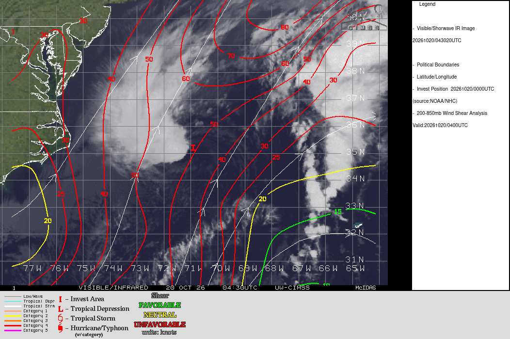
      #116352 - Tue Oct 20 2026 01:50 AM

That 'little bit of shear'

Credit: CIMSS


Post Extras: Print Post   Remind Me!   Notify Moderator  
Pages: 1


Extra information
0 registered and 0 anonymous users are browsing this forum.

Moderator:  CFHC, MikeC, Ed Dunham, Colleen A., Atricks, danielw, Clark, Christine H, RedingtonBeachGuy, SkeetoBite, Bloodstar, tpratch, typhoon_tip, cieldumort, Jackie M, Wigeon, Hank Buck 

Print Topic

Forum Permissions
      You cannot start new topics
      You cannot reply to topics
      HTML is disabled
      UBBCode is enabled

Rating:
Topic views: 364

Rate this topic

Jump to