Current Radar or Satellite Image

Flhurricane.com - Central Florida Hurricane Center - Tracking Storms since 199531 Years of Hurricanes Without the Hype - Since 1995


Subropical to Tropical development becoming more likely over the weekend into next week off the southeast to east coast. Could head inland.
Days since last Hurricane Landfall — US Any: 40 (Isaias), US Major: 770 (Milton), FL Any: 40 (Isaias), FL Major: 770 (Milton)
FlHurricane Atlantic Tropical Cyclone Tracking 🌀 Since 1995
None
HypeScale:
0.66
0510
Communication
Storm Data
Content
Follow & Connect


General Discussion >> 2026 Forecast Lounge

Jump to first unread post. Pages: 1
cieldumortModerator
Moderator


Reged:
Posts: 2951
Loc: Austin, Tx
Modeled Gulf Stream Hybrid
      #116361 - Wed Nov 18 2026 12:47 AM


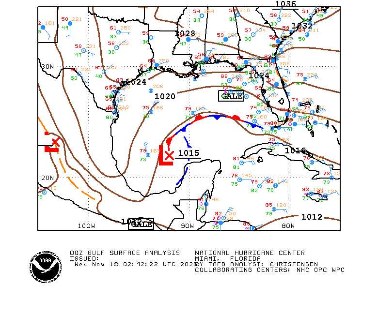
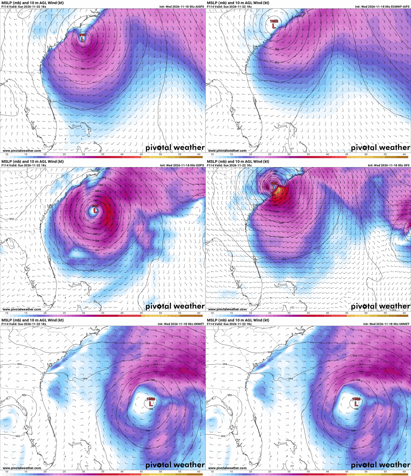
The complex non-tropical surface low pressure system southwest of Florida and responsible for draping the stationary front across or near the southern peninsula with locally torrential rain and flooding, is increasingly forecast by models, including an increasing number of the high-quality DeepMind ensembles, to acquire sub-tropical to tropical characteristics once it re-emerges or reforms over the Gulf Stream this weekend into next week. In addition, several models and/or their ensembles now take this low, which is likely to take shape regardless of classification, up the eastern seaboard. Given these trends, we are starting a Lounge on this feature at this time, Invest TBD.

More details to come


Post Extras: Print Post   Remind Me!   Notify Moderator  
cieldumortModerator
Moderator


Reged:
Posts: 2951
Loc: Austin, Tx
Re: Modeled Gulf Stream Hybrid [Re: cieldumort]
      #116362 - Wed Nov 18 2026 03:12 AM

18/0z Globals coming in with what is one of the stronger signals one would ever see during a November for potential nameable development in the Atlantic basin, by way of our complex frontal low pressure area reforming or splitting off with its stronger lobe revving up off the southeast coast. The models advertising stronger solutions are further west, across the Gulf Stream, weaker solutions forming further east.


Post Extras: Print Post   Remind Me!   Notify Moderator  
IsoFlame
Weather Analyst


Reged:
Posts: 421
Loc: One block off the Atlantic Oce...
Re: Modeled Gulf Stream Hybrid [Re: cieldumort]
      #116363 - Wed Nov 18 2026 08:42 PM

3 inches of rain last night, 5 inches today (as of 8pm). Sustained wind in 20-30 mph range with wind gusts of 50 mph in training rain bands off the Atlantic. If Kyle does form late in the week, it will hopefully be far enough offshore not to add to the flooding rains we are having in coastal Volusia.

--------------------
CoCoRaHS Weather Observer (FL-VL-42) & Surf Forecaster: https://www.surf-station.com/north-florida-surf-forecast-3/


Post Extras: Print Post   Remind Me!   Notify Moderator  
Pages: 1


Extra information
0 registered and 0 anonymous users are browsing this forum.

Moderator:  CFHC, MikeC, Ed Dunham, Colleen A., Atricks, danielw, Clark, Christine H, RedingtonBeachGuy, SkeetoBite, Bloodstar, tpratch, typhoon_tip, cieldumort, Jackie M, Wigeon, Hank Buck 

Print Topic

Forum Permissions
      You cannot start new topics
      You cannot reply to topics
      HTML is disabled
      UBBCode is enabled

Rating:
Topic views: 145

Rate this topic

Jump to