andy1tom
Storm Tracker

Reged:
Posts: 309
Loc: Callaway, Florida
|
|
check out this last time we had alex, bonnie,charley...... 14 named storms 10 hurricanes and the first one was...........july 27 and its name was alex.. see a pattern??1998 storms
Edited by andy1tom (Mon Aug 09 2004 01:06 AM)
|
andy1tom
Storm Tracker

Reged:
Posts: 309
Loc: Callaway, Florida
|
|
looks like it is getting it stuff together.. interesting what tomorrow morning will bring.
|
Steve
Senior Storm Chaser

Reged:
Posts: 1063
Loc: Metairie, LA
|
|
Not sure what to do with 91L. I'm giving my ideas a B+ so far. My early end game from last Monday or Tuesday called for a potential eastern Gulf threat. It's really hard to tell what might happen. The biggest player is the front expected to get to the Northern Gulf on Wed. or Thurs. How fast will it get here? How far south into the Gulf will it move? How are the models going to change if we end up with a Gulf system? If you missed it last night, I threw up an interesting scenario proposed for this season on the 91L contest thread. I wonder how I did on the 2nd half of the prediction scheme? Models I've looked at seem to indicate a hard right in the middle of the Gulf and toward the FL panhandle. That's plausible as is a west moving wave axis . There's just no way to determine yet what's going to happen. If you missed it, a Tropical Cyclone Formation Alert has been issued for 91L. As of the Hi-res IR tonight, it looks like the system is developing most on its southerly side. (Something we saw 8-10 days ago in the WPAC). Speaking of the WPAC, there are two invests up as well as Tropical Storm Rananim. This storm is anticipated to become a typhoon on its slow move north and then curve West toward Shanghai. & will be changing the tracks from time to time. But as of now, we're talking about a 6-10 day teleconnection of a ridge in eastern North America (and probably a strong one). What effect this has on 93L (which for my money, is looking better by the minute) into early-mid next week, if any, remains to be seen..
SOI has been averaging slightly negative for the last 6 days. A -6.4 value doesn't really scream, "El Nino is coming" but more likely signifies the 3 systems north of there.
-------------------------------------------------
Anyway, 91L could be a developing situation, or it may turn out to be nothing (what the models have been saying).
Steve /finishing off that Wild Turkey 101
--------------------
MF'n Super Bowl Champions
|
danielw
Moderator

Reged:
Posts: 3527
Loc: Hattiesburg,MS (31.3N 89.3W)
|
|
Ran the probable center location against a beam characteristic calculator.
Distance from Cancun radar to the center of storm determined by radar. At 0530Z, this was 070degrees at 71.5nm. Here are the results.
0.5deg Elev Angle
Beam Top Ht ARL- 10,700ft
Beam Ctr Ht ARL-7,200ft
Beam Bottom ht ARL-3700ft
Beamwidth-----------7100ft wide
This is for a WSR-88D radar and may not be accurate for Cancun radar.
http://www.wdtb.noaa.gov/resources/misc/beamwidth/beamwidth.htm
Edited by danielw (Mon Aug 09 2004 01:53 AM)
|
Anonymous
Unregistered
|
|
i think we have at least at TD2 again..... watching radar from cancun... center of cir.... in 4 pics (40 min worth) show a tight center of cir..... if its mid levl.... well looooks good.... cancun radar..... now she must survive the GOM for a few hrs today..... need less shear from the ne on monday...
is it me or have i noticed this system likes the night time....
*L* man Friday the 13th is coming....
|
Anonymous
Unregistered
|
|
000
AXNT20 KNHC 090546
TWDAT
TROPICAL WEATHER DISCUSSION
NWS TPC/NATIONAL HURRICANE CENTER MIAMI FL
205 AM EDT MON 09 AUG 2004
TROPICAL WEATHER DISCUSSION FOR NORTH AMERICA...CENTRAL
AMERICA...GULF OF MEXICO...CARIBBEAN SEA...NORTHERN SECTIONS
OF SOUTH AMERICA...AND ATLANTIC OCEAN TO THE AFRICAN COAST
FROM THE EQUATOR TO 32N. THE FOLLOWING INFORMATION IS BASED
ON SATELLITE IMAGERY...WEATHER OBSERVATIONS...RADAR...AND
METEOROLOGICAL ANALYSIS.
BASED ON 0000 UTC SURFACE ANALYSIS AND SATELLITE IMAGERY THROUGH
0515 UTC.
...SPECIAL FEATURES...
A 1013 MB LOW HAS DEVELOPED ALONG THE SURFACE TROF THAT EXTENDS
FROM 20N86W THROUGH THE YUCATAN CHANNEL TO 25N84W. THIS SYSTEM
IS THE REMNANT OF T.D. AND HAS THE POTENTIAL FOR
REDEVELOPMENT. RADAR IMAGES FROM CANCUN MEXICO CONFIRM THE
SATELLITE PRESENTATION WITH ROTATION NOTED IN THE YUCATAN
CHANNEL. SYSTEM APPEARS TO BE IN A LOW SHEAR ENVIRONMENT AS IT
ENTERS THE SE GULF TONIGHT. SCATTERED MODERATE/STRONG CONVECTION
COVERS THE AREA FROM 19N-23N BETWEEN 84W-88W.
|
Anonymous
Unregistered
|
|
if the low stays together for a few more hrs.....we will have bonnie by the 5:30....if not that, at the latest 11:30edt
wonder if the 1800Z recon will be bumped up?
|
Anonymous
Unregistered
|
|
Not at A 1013 MB preesure to high for a TS, maybe a TD.
|
James88
Weather Master

Reged:
Posts: 576
Loc: Gloucestershire, England, UK
|
|
T-numbers for the system are now up to 2.0/2.0, so we may well have a TD at the next advisory.
|
danielw
Moderator

Reged:
Posts: 3527
Loc: Hattiesburg,MS (31.3N 89.3W)
|
|
I wouldn't watch the pressure too closely. I know that's what we normally do. Alex formed up a pretty mean storm at near to sea level pressures. All the pressures in the GMX that I've seen are around 30.00in hg, or about 1015.9mb.
Lowest pressure observation, within 350nm of storm center, was from a ship at 22.6N 87.5W- 1014.0mb E winds at 18.1kts at 0600Z.
Edited by danielw (Mon Aug 09 2004 02:59 AM)
|
danielw
Moderator

Reged:
Posts: 3527
Loc: Hattiesburg,MS (31.3N 89.3W)
|
|
0615Z IR channel2 shows a large area with lightning covering the Northern semi-circle of the storm cluster.
http://www.ssd.noaa.gov/PS/TROP/DATA/RT/GMEX/IR2/20.jpg
|
James88
Weather Master

Reged:
Posts: 576
Loc: Gloucestershire, England, UK
|
|
Both systems now have the support of the model. It takes the former TD into western Florida as a hurricane and then has it moving up towards Long Island.
Hurricane Bonnie?
It also takes 93L through the Caribbean as a hurricane.
Hurricane ?
This is shaping up to be a very interesting week!
|
WeatherNLU
Meteorologist

Reged:
Posts: 212
Loc: New Orleans, LA
|
|
Goodness, look at the loop of the GOM on !!! The last two hours and all of a sudden we have what looks serious on our hands. I mean it's really gotten it's act together in the last say three hours. Anyone else up at this hour and agree. Maybe I just need some sleep!
--------------------
I survived Hurricane Katrina, but nothing I owned did!
|
WeatherNLU
Meteorologist

Reged:
Posts: 212
Loc: New Orleans, LA
|
|
OK, I just watched again and dang! It's certainally there and I'm not sleeping.
--------------------
I survived Hurricane Katrina, but nothing I owned did!
|
WeatherNLU
Meteorologist

Reged:
Posts: 212
Loc: New Orleans, LA
|
|
OK, I know this is getting repetitive, but I am talking to myself. If that's not at least a TD again I better find a new profession, because I'd bet my bottom dollar that we have Bonnie.
--------------------
I survived Hurricane Katrina, but nothing I owned did!
Edited by WeatherNLU (Mon Aug 09 2004 04:06 AM)
|
James88
Weather Master

Reged:
Posts: 576
Loc: Gloucestershire, England, UK
|
|
I have to agree with you, the system is looking quite good this morning. It would be surprising if we didn't get a classified system by this evening.
|
WeatherNLU
Meteorologist

Reged:
Posts: 212
Loc: New Orleans, LA
|
|
Hey I am not talking to myself at this god awful hour. Couldn't agree more James. Very impressive looking, I might be jumping the gun, but just from my eye it's already Bonnie. Of course I'd love to have some pressure and wind readings from that area to verify, but taking into account simply the presentation, I'd say we have something.
--------------------
I survived Hurricane Katrina, but nothing I owned did!
|
LadyStorm
Weather Guru

Reged:
Posts: 154
Loc: United States
|
|
You're not dreaming. I think we will have a Bonnie by tonight. Very impressive system on radar.
MaryAnn 
Quote:
Hey I am not talking to myself at this god awful hour. Couldn't agree more James. Very impressive looking, I might be jumping the gun, but just from my eye it's already Bonnie. Of course I'd love to have some pressure and wind readings from that area to verify, but taking into account simply the presentation, I'd say we have something.
--------------------
"The significant problems we face cannot be solved at the same level of
thinking we were at when we created them"
..........Albert Einstein
Edited by LadyStorm (Mon Aug 09 2004 06:00 AM)
|
danielw
Moderator

Reged:
Posts: 3527
Loc: Hattiesburg,MS (31.3N 89.3W)
|
|
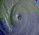
Here is the satellite link.
http://www.tnrcc.state.tx.us/updated/air/monops/data/satellite/GOES/GULF/ir/latest.jpeg
http://rsd.gsfc.nasa.gov/goeseast/hurricane/color/0000_latest.jpg
Edited by Ed Dunham (Mon Aug 09 2004 07:55 PM)
|
GuppieGrouper
Weather Master
Reged:
Posts: 596
Loc: Polk County, Florida
|
|
This system looks like a TS to the nude eye! Who has the statistics on this one?(Yucatan) There appears to be banding and the tail is as well formed as ole Alex had.Uh oh here I am talking about animals again. I know this one will make it to the other forum. But really. IF this is Bonnie, we do not have much time to ooh and aww over it until it gets some one.
Edited by Ed Dunham (Mon Aug 09 2004 07:56 PM)
|


 Threaded


