AgentB
Weather Guru

Reged:
Posts: 188
Loc: Winter Park, FL
|
|
Surge maps for Volusia/Brevard/Indian River/St Lucie/Martin Counties. Try checking your local NWS site as I found these on the local NWS(Melbourne) site.
http://www.srh.noaa.gov/mlb/atlas.html
--------------------
Check the Surf
|
MrSpock
Storm Tracker
Reged:
Posts: 296
|
|
262
URNT12 KNHC 101738
VORTEX DATA MESSAGE
A. 10/1738Z
B. 16 DEG 45 MIN N
75 DEG 42 MIN W
C. 700 MB 2568 M
D. 90 KT
E. 111 DEG 016 NM
F. 183 DEG 112 KT
G. 095 DEG 010 NM
H. 940 MB
I. 9 C/ 3063 M
J. 17 C/ 3068 M
K. 10 C/ NA
L. CLOSED WALL
M. C16
N. 12345/07
O. .1/1 NM
P. AF984 1509A OB 07
MAX FL WIND 112 KT E QUAD 1735Z.
One difference that stands out vs. the last one, is that it now has a closed eyewall. Pressure is also the highest it has been in a while, but we'll see if it responds to the recent eyewall closing and convection.
Edited by MrSpock (Fri Sep 10 2004 06:19 PM)
|
Wxwatcher2
Storm Tracker

Reged:
Posts: 337
Loc:
|
|
940 mb's good news.
let's hope the pressure keeps rising.
|
LI Phil
User

Reged:
Posts: 2637
Loc: Long Island (40.7N 73.6W)
|
|
You guys are doing better than I am...throw them all up here...they're bound to help someone.
Thank your newest Moderator, Storm Cooper, for this one.
santa rosa
the mother lode
--------------------
2005 Forecast: 14/7/4
BUCKLE UP!
"If your topic ain't tropic, your post will be toast"
Edited by LI Phil (Fri Sep 10 2004 06:23 PM)
|
SoonerShawn
Unregistered
|
|
Folks, if continues on the path he is currently on he is going to miss Jamaica to the south by a good margin. What changes, if any, could this mean for more of a panhandle or Alabama landfall? Or I guess it could also be more east as a landfall!?!?
What are you talking about? He's taking dead aim at the Island.
ShawnS
Edited by LI Phil (Fri Sep 10 2004 06:21 PM)
|
MrSpock
Storm Tracker
Reged:
Posts: 296
|
|
I think it is too early to tell. It could be a wobble, or an . The models don't seem to have changed much yet. Here is the model run discussion from this morning:
http://www.hpc.ncep.noaa.gov/discussions/pmdhmd.html
|
rickonboat
Weather Hobbyist
Reged:
Posts: 90
|
|
I thought yesterday the storm would go south of Jamaica about 60-100 miles...and now...it looks like that is correct. As I fear, the WORST CASE SCENARIO for us is for the storm to traverse the Yucatan Channel...
what are the "experts" saying now?
|
MrSpock
Storm Tracker
Reged:
Posts: 296
|
|
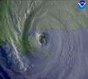
overlaying the forecast plots onto the satellite, and it looks to be right where projected.
http://www.ssd.noaa.gov/PS/TROP/DATA/RT/float-ir4-loop.html
|
LI Phil
User

Reged:
Posts: 2637
Loc: Long Island (40.7N 73.6W)
|
|
This map shows storm surge for a hurricane hitting Mobile Bay. Notice that it shows how much destruction a CAT V would cause...
--------------------
2005 Forecast: 14/7/4
BUCKLE UP!
"If your topic ain't tropic, your post will be toast"
|
SoonerShawn
Unregistered
|
|
What's your deal with all the edits? Are you getting power hungry or something? The last couple of hrs certainly shows a more westerly track and I'm not the only one who is seeing it. If it DOES CONTINUE this the eye will go south of Jamaica.
ShawnS
|
Kdubs
Weather Watcher

Reged:
Posts: 44
Loc: Orlando, FL
|
|
I hate to bother you weather brains out there, but can someone tell me what an "SST" is? Thanks
--------------------
South Orlando 
God Bless
A B C D E F G H I J K L
Bold = Reached hurricane status
Italics = Impacted Florida
|
Rasvar
Weather Master

Reged:
Posts: 571
Loc: Tallahassee, Fl
|
|
If it is going 60-100 miles south of Jamica, then someone just moved the island 60-100 miles north. Think you need new glasses on this one, riconaboat.
|
Storm Cooper
User
Reged:
Posts: 1290
Loc: Panama City , FL
|
|
Sea Surface Temps
--------------------
Hurricane Season 2017 13/7/1
|
WeatherNLU
Meteorologist

Reged:
Posts: 212
Loc: New Orleans, LA
|
|
Quote:
I hate to bother you weather brains out there, but can someone tell me what an "SST" is? Thanks
Depends on the context, but probably sea surface temperature.
--------------------
I survived Hurricane Katrina, but nothing I owned did!
|
Jamiewx
Storm Tracker

Reged:
Posts: 371
Loc: Orlando, Florida
|
|
Kdub, SST stands for Sea Surface Temperature.
Note the discussion says the center will skirt jamaica's south coast.
Here is some of the NWS Tampa Bay Discussion from this afternoon.
".LONG TERM (SUN NIGHT - FRI)...IN GENERAL...IT'S NOT A MATTER OF WHERE...OR PERHAPS WHEN...AS MODEL SOLUTIONS CONTINUE TO CONVERGE. THE WHERE IS...FOR THE FOURTH TIME THIS SEASON(BONNIE/CHARLEY/FRANCES/IVAN)...THE STATE OF FLORIDA. THE WHEN IS MONDAY NIGHT THROUGH TUESDAY NIGHT DEPENDING ON WHICH PART OF THE STATE YOU LIVE. HOWEVER...AS WITH ...THE EVENTUAL PRECISE TRACK IS STILL UNCERTAIN...BUT A GENERAL NORTH HEADING MEANS THE STORM COULD LANDFALL ANYWHERE ON THE PENINSULA WITH JUST A NUDGE.
THE OMINOUS SIGNS POINT TO THE EASTERN GULF COAST ANYWHERE FROM THE KEYS TO THE BIG BEND AS SYSTEM CONTINUES TO TRACK WNW. APPEARS RESTRENGTHENING INNER EASTERN EYEWALL WILL POUND JAMAICA THIS EVENING AS THE CENTER SKIRTS THE ISLAND'S SOUTH COAST...THEN A SLIGHTLY SLOWER...BUT STILL STEADY...MOTION WILL ENSUE AS IT EASES TOWARD THE WESTERN CUBA COAST BY EARLY SUNDAY.
AT THAT TIME...WE SHOULD KNOW WHETHER THE STORM WILL MAKE LANDFALL ON THE PENINSULA OR PERHAPS IN THE BIG BEND REGION. AND INITIALIZED MODELS SUGGEST THIS POSSIBILITY...BUT CONSENSUS AND ENSEMBLES LEAN TOWARD THE PENINSULA. BASED ON WATER VAPOR...WHICH SHOWS THE END OF THE WESTWARD EXPANSION OF THE SUBTROPICAL RIDGE AND THE REMNANT TROUGHING FROM ...AM AFRAID THE STORM WILL CIRCLE THE PERIPHERY AND LAND SOMEWHERE ON THE SUNCOAST BEFORE EDGING NNE.
FOR INTEREST...THIS HAS MANY EARMARKS OF (NOT GOOD) BUT IS LARGER AND MORE ORGANIZED...MEANING IT HAS POTENTIAL TO CREATE A WIDER WIND DAMAGE SWATH AS WELL AS HEAVIER RAINS (WORSE!). ONE POSSIBLE SAVING GRACE IS THAT THE SYSTEM MAY ENCOUNTER SOME SHEAR AS IT APPROACHES ON MONDAY...PERHAPS REDUCING THE CORE WINDS SOMEWHAT. BUT THAT WON'T STOP THE RAIN...WHICH WILL BE THE LONG TERM PROBLEM."
Edited by Jamiewx (Fri Sep 10 2004 06:41 PM)
|
AgentB
Weather Guru

Reged:
Posts: 188
Loc: Winter Park, FL
|
|
Quote:
I hate to bother you weather brains out there, but can someone tell me what an "SST" is? Thanks
Sea Surface Temperature.
LOL...looks like I was about 5 posts too late.
--------------------
Check the Surf
Edited by AgentB (Fri Sep 10 2004 06:37 PM)
|
Wxwatcher2
Storm Tracker

Reged:
Posts: 337
Loc:
|
|
I agree the eye looks like it may go South of Jamaica.
this is a good thing for the Island.
Whats the problem?
|
rickonboat
Weather Hobbyist
Reged:
Posts: 90
|
|
Appreciate that map of Mobile, LI Phil...thanks..
Yeah, anyone who gets this hurricane..gets big problems....
will miss Jamaica, mon...and glad of that...
hey, maybe it will get into the gulf...stall...and die...
who knows...
|
MrSpock
Storm Tracker
Reged:
Posts: 296
|
|
sea surface temperature.
|
Rasvar
Weather Master

Reged:
Posts: 571
Loc: Tallahassee, Fl
|
|
If the definition of going south of the island means the center stays a few miles off shore, then yes, it may go south and miss the island. However, the eyewall appears almost certain to scrape the heck out of the south coast. In my book, since that is where the winds are, it is a hit.
|


 Threaded


