MikeC
Admin
Reged:
Posts: 4635
Loc: Orlando, FL
|
|
9:50AM Update - July 7th
Dennis has made a northwestern jog over the last few hours and now it is likely to pass slightly north of Jamaica, as the forecasted. Some of the model guidance has trended to the east again, we'll watch for persistence with the trends. If this persists it will force the keys to be under a watch tomorrow.

7:45AM Update - July 7th
Hurricane is now up to 105MPH Winds as it moves toward Jamaica. It is possible for it to reach Category 3 before nearing Jamaica.
7:00AM Update - July 7th
No real changes this morning, pressures are still dropping on , and tge windspeed is up, probably up some more at the 8AM advisory.
The future track hasn't changed much, still moving it into the gulf, west of the Florida peninsula and up toward the western panhandle toward New Orleans area, very similar to Hurricane 's track last year. There is still a chance of varience in the late track, but trends seem to be settling on here for now.
How affects Jamaica, whether it passes north, south, or directy over the island, is still up for grabs. Jaimaica's mountainous interaction with the storm seems to do odd things (see ) so it'll be something to watch as it approaches there. People in Jamaica need to be prepared already.
Other places will still want to keep a watch through the weekend.
10:40PM Update
The Cayman Islands are now under a hurricane warning. Winds are up to 85MPH. Not much change on future track, or the certainty of it in the future. One good thing is that toward the end of the storm's path wind shear is forecast to increase, which may weaken the storm before landfall.
Additionally, another wave have come off the African coast, but for sanity's sake we won't mention that much more for a while unless something occurs. It's too early for long trackers, but you never know with this season.
8:45PM Update (Clark)
A slowing from 20mph down to 13mph, gradually over time, is more indicative of the system actually slowing down and not wobbles in the storm's path. It's reached an area where the steering currents are not as strong as they were towards the east; this motion should continue for another day or so before accelerating just slightly. However, any slowing and/or any hint of the storm becoming elongated north-south are prime indicators of a northward turn either in progress or about to occur.

Don't have time for a full update, but will leave you all with this: watch the shortwave current moving SE over central Kansas. It, coupled with the weak vortex near Dallas, are going to be the prime factors that influence to move north -- or not move north -- over the coming days. If the Kansas vortex continues to dive southward, the trough behind Cindy is going to become more amplified and likely capture before the models are predicting; the Dallas vortex may help this occur. If it begins to move towards the east, with the flow, should continue on a NW path to landfall in Louisiana. There is impetus for both scenarios to occur, but which one actually plays out remains to be seen. Right now, I would begin to believe the former rather than the latter, based off of synoptic trends and looking upstream over the northern Rockies, but there is some indication for the latter to occur as well.
The subtropical ridge is a bit weaker today than it was yesterday, though is pinched in the eastern Gulf by the remnants of Cindy's circulation. It extends to the Yucutan on its southern/southwestern extent, but only to Cedar Key, FL on the northern/northwestern side of things. These shortwaves should help keep the former in place and influence the latter; how much of this occurs will determine where the storm goes. bumping into it may play a role as well. There's still the chance of it slowing/stalling in the SE Gulf in 3-4 days, particularly if it gets caught outside of the influence of the ridge and the shortwave troughs, but I still don't consider it likely.
Do feel pretty confident, however, in saying that the & UKMET are definitely on the west side of things, and the Canadian model is on the east side of things (though it is too fast). Slight ridging appears to be building over the intermountain western U.S., which would imply slight troughing along the east coast and a more northerly track for the storm, but again -- it's all about how much of an impact it has on . I can say, though, that as long as this giant upper low sits over the Pacific northwest of Hawaii, the pattern isn't going to shift greatly for awhile. Not exactly the greatest news for down the line into the season, though it'll likely weaken/break out before too long (just off of climatological factors alone).
Original Update
has now become a Hurricane, with 80MPH winds, expected to strengthen more over the next day or so as it gets closer to Jamaica. The current forecast track takes the center barely just north of Jamaica, but close enough to be felt. Folks there should prepare as if it may strike directly. Hurricane Warnings are up there.
After that, it will approach the Caymans and Cross over Cuba and likely enter the Gulf. Things are still somewhat uncertain after that, and the cone of error is large. But current model trends suggest the big Benda and Florida panhandle and points west toward New Orleans with the highest threat on Monday. However it may come close enough to the Florida Keys to cause concern there this weekend, and the cone still includes the west coast of Florida, so do not rule those out quite yet.
Bottom line is we still don't have a clear grasp of the storm 3 days out or so.
 
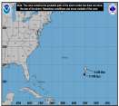
Do not focus on the line in the above maps, the storm is large and the cone of error that far out is even larger! I know those of you who had to deal with last year do not like that map.
Event Related Links
Monroe County/Florida Keys Emergency Management Bulletins
StormCarib hurricane reports from observers in the Islands - Jamaican StormCarib Reports
Caribbean Island Weather Reports
Jamaican Meteorological Service
Guantanamo Bay, Cuba Radar
Florida Keys Long Range Radar Loop
Dennis
Animated Model Plot of
Model Plot Graphic from the South Florida Water Management District of
Dennis Spaghetti Model from boatus
Weather Underground Model Plots for
Quikskat Image of
Floater Satellite (Visible) of with Storm Track Overlays
RAMSDIS high speed visible Floater of
Forecast Discussions for (Show All Locations):
Tampa. Mobile Bay,
New Orleans, Key West, Tallahassee.
Melbourne
|
Rich B
British Meteorologist
Reged:
Posts: 498
Loc: Gloucestershire, England, UK
|
|
Well it took a little longer than some of us may have expected, but is now a 80mph Hurricane, and the first of the season. The structure of the hurricane still seems to be in a state of flux, with convection now reorganising after a bit of a pause earlier. Still, it looks as if the centre will move very near to Jamaica tomorrow, and personally i think it will be at Cat 2 when it does so. Certainly something the folks there dont need, let along the potential for 12" of rain too. Certainly one that anyone in the northwest Caribbean and anywhere around the GOM needs to be closely watching!
--------------------
Rich B
SkyWarn UK
|
Rick on boat in Mobile
Weather Drama Guru

Reged:
Posts: 161
|
|
If you look at the water vapor image, every thirty minute loop...it really shows taking form...
It'll be a category two by tomorrow......possibly a cat three
entering the warm waters of the gulf as a major hurricane...
I bet you couldn't buy insurance right now...anywhere....and the insurance companies oughta pretty much go bankrupt this year.....
my boat insurance went up 40% because of the 4 hurricanes hitting Florida...and I paid it reluctantly....
glad I did...
|
Frank P
Veteran Storm Chaser
Reged:
Posts: 1299
|
|
Boy its hard to believe that on the 's present 5 day track this thing will impact the same area as .... that's unbelievable, and I would not be surprised if it does happen... this probably would even be worse than if comes in as a Cat 3.... If I was in Pensacoula I would be in shock right now.... you hope no ones gets a major but geesh I'd really hate to see these poor folks take another major hit like this.... I would think there is an outside chance that might weaking somewhat with the upwelling caused by Cindy but still a strong Cat 2 or weak Cat 3 is nothing to sneeze at...... especially in an area already devistated from fury last year.... I just hope it goes anywhere but where went.... expect of course Biloxi.... 
|
Lysis
User

Reged:
Posts: 451
Loc: Hong Kong
|
|
.... Ahem, or Punta Gorda. We went to the map store to pick up my new tracking map today (waterproof and laminated...) and we drove by the massive feema trailer park set up for people who still don't have houses.
--------------------
cheers
Edited by Lysis (Wed Jul 06 2005 06:37 PM)
|
FlaMommy
Storm Tracker

Reged:
Posts: 225
Loc: Tampa(Riverview), Florida
|
|
poor lysis....i hope it doesnt hit us.... 
--------------------
"Haven't thought of a witty one lately"
|
firestar_1
Weather Hobbyist

Reged:
Posts: 64
Loc: Port Charlotte, FL, 26.98N 82....
|
|
I don't know about you, but I am not liking the feeling I am getting about this one.....already told the girlfriend to plane on leaving the area Saturday if this thing stays close to the coast...too much trash still laying around to handle high winds well........ 
--------------------
Stay Aware...Stay Alert....Stay Alive.....
|
Southern4sure
Weather Guru

Reged:
Posts: 121
Loc: Land O Lakes, FL
|
|
Quote:
poor lysis....i hope it doesnt hit us.... 
I agree with you. I ran from , I hope I dont have to run from !
|
Frank P
Veteran Storm Chaser
Reged:
Posts: 1299
|
|
my bad Lysis, Punta Gorda would be tied with Pensacola as a city that I don't want to go to... and I'll put Biloxi third on my list behind these two cities that were pummeled last year.... but at least yall don't have the bulleye painted on you at the moment... but as we all know that could change....
|
firestar_1
Weather Hobbyist

Reged:
Posts: 64
Loc: Port Charlotte, FL, 26.98N 82....
|
|
At least the media isn't telling everyone it is going to hit Tampa....then I would really begin to worry...... 
--------------------
Stay Aware...Stay Alert....Stay Alive.....
|
GuppieGrouper
Weather Master
Reged:
Posts: 596
Loc: Polk County, Florida
|
|
Looking around at my list of TV media weather pages, I am seeing a lot of wishcasting about sending the hurricane other places.
--------------------
God commands. Laymen guess. Scientists record.
|
MapMaster
Unregistered
|
|
YET...
MM
|
Frank P
Veteran Storm Chaser
Reged:
Posts: 1299
|
|
Yeah, and I got two Disney World trips planned and I sure would hate to see whats left of the temporary I-10 bridge in the Pensacola Bay when I need to use it in Oct and Dec... because a Cat 3 will probably take it down like did with the original.... maybe Fl will luck out an this thing will go more west, towards Central or West La... we'll have a pretty good idea by Friday evening I would imagine
|
OrlandoDan
Weather Master

Reged:
Posts: 456
Loc: Longwood, FL
|
|
Judging from the latest IR Loop, this thing really exploded recently.
Everyone in the gulf should keep an eye on this. It is still pretty far out.
|
FlaMommy
Storm Tracker

Reged:
Posts: 225
Loc: Tampa(Riverview), Florida
|
|
ok now im in tampa...i didnt really need to see that;)....jk....i sure hope we dont get hit...that would spell disaster im thinking for alot of people...like myself...but im somewhat ready if it does decide to make that choice.... 
--------------------
"Haven't thought of a witty one lately"
|
Rabbit
Weather Master

Reged:
Posts: 511
Loc: Central Florida
|
|
first, one thing: does anyone other than me think Cindy was a minimal hurricane at landfall?
someone mentioned the Africa system in teh other thread, and this is from the TWD at 2:30:
EAST ATLANTIC TROPICAL WAVE IS LOCATED IN THE VICINITY OF 30W S
OF 23N. UPPER AIR SOUNDINGS FROM DAKAR AND SAL SHOW WAVE PASSAGE
NEAR 18Z JUL 3 AND 18Z JUL 4...RESPECTIVELY...WHICH SUPPORTS A
SLOW WWD TRANSLATION OF 5-10 KT. THE WAVE PRESENTS A COMPLEX
STRUCTURE AT THE MOMENT. MET-7 VISIBLE IMAGERY SHOWS A STRONG LOW-LEVEL CIRCULATION ABOUT 200 NM SW OF THE CAPE VERDES...WHICH
IS SUPPORTED BY QUIKSCAT IMAGERY...
IR
VIS
98L by Friday probably if it holds together
Dennis is now strengthening, and the dry air to the west that was there earlier is now gone, replaced by a fully-wrapped . The outflow has also become better defined in the last several hours. I expect we will see an eye begin to form before the end of the night. Anyone think it will become a Cat IV?
Is this early July or late August??
|
Southern4sure
Weather Guru

Reged:
Posts: 121
Loc: Land O Lakes, FL
|
|
For all you seasoned hurricane watchers in the Tampa area, Who do you rely on the most for your local hurricane info? I do not know who is more accurate since I just moved here in Jan.
Thanks in advance
|
Hurricane Fredrick 1979
Weather Guru

Reged:
Posts: 116
Loc: Mobile,Alabama
|
|
Quote:
I don't know about you, but I am not liking the feeling I am getting about this one.....already told the girlfriend to plane on leaving the area Saturday if this thing stays close to the coast...too much trash still laying around to handle high winds well........ 
I got limbs to pick up from today (Cindy) but I told my wife that I was gonna wait till the big one comes and goes then pick it all up at one time.
|
bigpapi
Weather Watcher
Reged:
Posts: 31
Loc: Myrtle Beach, SC
|
|
Looking at the last visible, it's hard to tell which direction is heading. However the whole system seems to be pulling more NW now. Is that just an illusion due to a growing system?? 
|
FlaMommy
Storm Tracker

Reged:
Posts: 225
Loc: Tampa(Riverview), Florida
|
|
hi southern ...well...to be honest with you....alot of the meteorologists here in tampa pretty much hype things up or they sugar coat everything....there have been several stations insisting that tampa is out of the running which i firmly dont believe...i honestly listen to what is being said here more so than on my local channels....just my opinion....stay safe and pray we dont get it.... 
--------------------
"Haven't thought of a witty one lately"
|


 Threaded


