MikeC
Admin
Reged:
Posts: 4693
Loc: Orlando, FL
|
|
Friday - 9PM CDT UPDATE
From the :
THE 8 PM CDT POSITION...28.7 N... 93.0 W. MOVEMENT TOWARD...NORTHWEST NEAR 11 MPH. MAXIMUM SUSTAINED WINDS...120 MPH.
MINIMUM CENTRAL PRESSURE... 931 MB.
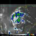
Hurricane still a Category III Hurricane and she should make landfall - probably in extreme southwest Louisiana (Cameron Parish) at about 5am CDT - as a Category III Hurricane with sustained winds of at least 115mph. 's forward motion now appears to be shifting toward the north northwest since the 8PM CDT bulletin. Hurricane force winds will soon batter the northeast Texas and southwest Louisiana coast with extreme conditions likely in the early morning hours from High Island, Texas, to Garden City, Louisiana, and hurricane force conditions west and east of those points. High storm surge at and east of the landfall point could easily exceed 16 feet since will be approaching almost perpendicular to the coast. Expected isolated wind gusts up to 140mph. Embedded fast moving tornadoes are likely over all of Louisiana and portions of southeastern Texas. Rainfall along east Texas and west Louisiana could easily exceed 15 inches as slows in her northward movement after landfall and creates widespread flooding.
ED
6:20PM EDT Update
Rita still is slowly weakening, this time at 931mb (from recon). Hopefully it will weaken some more before making landfall.
A combination of eyewall replacement, shear, and dry air is causing the storm to lose some steam. It may gradually weaken more as it approaches near Port Arthur overnight.
However, is still a very strong major hurricane, with very low pressure. A lot of the momentum and surge still exists with the system, and extreme flooding is still very likely.

What's surprising is what some of the models are saying will happen after it makes landfall, perhaps a stall, and perhaps a loop over texas and briefly back over the Gulf.
I've begun recording coastal radar of you can see that here It will remain until is out of range.
Level 3 radar recording courtesy HCW here.
1:20PM Update:
Rita continues to move Northwest, wobbling, as it nears the coast. It appears to be holding at it's current intensity, the 2PM (1PM CDT) advisory should update that.

I've begun recording coastal radar of you can see that here It will remain until is out of range.
Original Update
Rita's held it's intensity overnight, and it will likely hold or weaken some today.
What is happening this morning is that a bit of a weakness of dry air appears to be developing west of the eye which will either weaken or continue to hold the storm into check. 's finished the eyewall replacement cycle and the water below it is about to get warmer (it is entering one of the warm eddys in the Gulf). But with the dry air entering in now I only see it holding or weakening at least this morning. It does have a shot to strengthen a bit, but it isn't as likely.
Folks in the hurricane Warning area need to already be prepared, things will start to deteriorate this afternoon. Folks along coastal areas should be evacuated. If you are in the warning area and are readinging this near the coast, shut it off now and leave.

Rita likely will still remain a major hurricane at landfall, which will be sometime overnight tonight or early tomorrow morning, and the National Hurricane Center track to make landfall near Port Arthur Texas has not changed since last night.

Image courtesy SkeetobiteWeather.com
Comments/Feedback on the maps look here.
Rita will also likely begin to slow down forward motion as it moves northwest, likely stalling over northeast texas.
Points immediately east of the eye will receive the worst of the storm surge.
Philippe is transitioning into an storm and moving away. South of Bermuda, about 500 miles, another wave is worthy of being watched for development over the next few days. This one is likely to stay out to sea also.
Event-Related Links
Emergency Management:
Texas Division of Emergency Management
Links to Texas County Emergency Management
Radars
Florida Keys Long Range Radar Loop
Houston/Galveston, TX Long Range Radar
Corpus Christi, TX Long Range Radar
Brownsville, TX Long Range Radar
Lake Charles, LA Long Range Radar
New Orelans, LA Long Range Radar
Spaghetti Style model plots from Colorado State University
Forecast Discussions for (Show All Locations):
Corpus Christi, TX, Houston/Galveston, Lake Charles, LA
New Orleans, LA
Brownsville, TX
StormCarib hurricane reports from observers in the Islands
Caribbean Island Weather Reports
Color Sat of Gulf
RAMSDIS high speed visible Floater of Storms
Video/Audio
Local Media/Television
KHOU the CBS affiliate in houston, is former Hurricane Center director Neil Frank's station, and likely will begin streaming once warnings are up in the area
Channel 2 NBC affiliate in Houston
ABC 13 in Houston
Lake Charles/Layfette Local Television
KATC TV
<a href="mms://a560.l1058140497.c10581.g.lm.akamaistream.net/D/560/10581/v0001/reflector:40497" target="_blank">KLPC</a>
Radio
KTRH Rado News/Talk station in Houston with streaming
Other Houston area radio
Newspapers
Houston Chronicle
Web based Video and Audio
Many websites require realplayer for video and audio, you can get real player here or an alternative real media player here (Ie WinXp64)
Jim Williams, from Hurricane City and West Palm Beach, will likely be doing his live audio show as approaches on hurricanecity. Listen here
Marc Sudduth over at hurricanetrack.com is heading toward South Floirda see some of his live streaming video and audio here
Hurricanenow - Former CNN hurricane Reporter Jeff Flock reports from the storm with video updates and live streaming
Weathervine.com storm chasers/video/audio
radioNHCWX (not affiliated with the real )
Barometer Bob
Reply and let us know of other links.
Rita

Animated model plots of
Google Map plot of
Floater satellite loops (With forecast track overlay):
Rita Floater Visible Satellite Loop
Rita Floater Infrared Satellite Loop
Rita Floater Shortwave Infrared Satellite Loop
Rita Loop
Rita Water Vapor Loop
Philippe

Animated model plots of Philippe
98L

|
Margie
Senior Storm Chaser

Reged:
Posts: 1191
Loc: Twin Cities
|
|
Looks like the eye is just barely starting to show up on NOLA long-range radar:
http://radar.weather.gov/radar/loop/DS.p20-r/si.klix.shtml
--------------------
Katrina's Surge: http://www.wunderground.com/hurricane/Katrinas_surge_contents.asp
|
nate77
Weather Hobbyist
Reged:
Posts: 80
|
|
KHOU.COM is saying that they dont know how much longer can keep this a CAT 4 with the pressure raising.
|
jth
Storm Tracker
Reged:
Posts: 275
|
|
Look again....pressure back down to 927 per last vortex message.
|
NewWatcher
Storm Tracker

Reged:
Posts: 388
Loc: Port Orange, FL
|
|
RC or anyone,
Do you know a site to lookup hurricane info not by year but by statistical input. In other words, I am trying to find out the last year we had 2 cat 5's in the same year. someone said 1915 but i heard it was in the 60's sometime.
thanks
--------------------
Pam in Volusia County
According to Colleen A ... "I AM A HURRICANE FREAK"
2007 Predictions 16/9/6
|
Ormond Suzie
Weather Watcher
Reged:
Posts: 28
Loc: Ormond Beach, Florida
|
|
TWC last night listed 3 times that double 5s had happened. One that I remember was Donna & Ethel. That would have been late 50s or early 60s. WeatherUnderground should have the date.
Edit: I just checked, and Donna & Ethel were both Cat 5 in 1960.
Edited by Ormond Suzie (Fri Sep 23 2005 08:42 AM)
|
nate77
Weather Hobbyist
Reged:
Posts: 80
|
|
Quote:
RC or anyone,
Do you know a site to lookup hurricane info not by year but by statistical input. In other words, I am trying to find out the last year we had 2 cat 5's hit in the same year. someone said 1915 but i heard it was in the 60's sometime.
thanks
Katrina hit as a Cat 4 and this one may hit as a CAT 3.
|
Lee-Delray
Weather Master

Reged:
Posts: 429
|
|
The pressure is up to 930mb as of 8 AM
|
MadDog
Weather Hobbyist
Reged:
Posts: 51
Loc: DeBary, Florida
|
|
Donna was September 1960. I know that because my mom was extremely pregnant with me and hiding under an overturned couch when Donna went over.
Edited by MadDog (Fri Sep 23 2005 08:41 AM)
|
Rick on boat in Mobile
Weather Drama Guru

Reged:
Posts: 161
|
|
is to be commended. I have come to the conclusion that for me to "predict" where I think a hurricane will go is just a stupid guess. I will continue to see if I can make observations...but I have a lot to learn...
at least I was right about a possible Louisiana hit.
In the Mobile area, the water at the marina is 2 ft above the walkway. I had to wade to the truck...not sure how much higher it will get. just a small note on how powerful the storm surge will be...
anyone staying on the coast...is toast
|
Wxwatcher2
Storm Tracker

Reged:
Posts: 337
Loc:
|
|
Really good news about the pressure rising.
Let's hope it rises dramatically throughout the day and that 's punch will be even more diminished as the storm approaches the Tx/La coastline.
While it's (fun?) to track a Cat 5 and keep track of records etc etc, I for one would be most pleased to see this one fizzle as it approaches the coast.
We have a major problem all along the coastline with moving people to safety.
What a monumental task the has to issue warnings in a timely manner but yet the local authorities have the task of evacuating in some cases, millions, of people. As we've seen in the Houston area evacuations, the roads and gas stations etc simply can not handle the massive numbers of vehicles on the roads.
I'm sure that many of those who gladly evacuated this time will not do so next time simply because of the traffic.
There will be time for these discussions, Now, our thoughts are with all of those communities in harms way.
I have said this before and I will say it again. In years past, it was sort of a fun hobby....tracking hurricanes.
Last season and especially this one have made me painfully aware of the costs, pain, and suffering that is caused and the ripple affect that is produced throughout the country by the storms.
Therefore, my excitement for seeing a Cat 5 and getting all worked up over numbers has ended.
All I care is for this thing to eat lots of dry air and get a tummy ache before landfall.
|
lunkerhunter
Storm Tracker

Reged:
Posts: 248
Loc: Saint Augustine, FL
|
|
Storm Surge Forecast Link
Storm Surge Graphs Link
|
Rick on boat in Mobile
Weather Drama Guru

Reged:
Posts: 161
|
|
are located on the eastern side of the Texas, La border....near the coast
Rita is bee-lining for them.
|
Rick on boat in Mobile
Weather Drama Guru

Reged:
Posts: 161
|
|
oops...I haven't had enough coffee yet. I shoulda said the western side....(Texas) sorry
|
rhendryx
Verified CFHC User
Reged:
Posts: 23
Loc: Tampa, FL
|
|
Rick,
I think there is something in the very nature of humans that wants to recognize patterns and project future trends. Similarly, I have been guilty of looking for price movement in stock market charts to achieve symmetry, and have found myself not only, disappointed, but poorer, when future stock movements did not meet my symetrical expectations! 
With hurricane tracking, I purposely keep my track predictions to myself, as it is easy to look at every little jog and jag in satellite imagery as confirmation of one's anticipated trend. On another board, I have noticed a certain poster who lives in SW Louisiana and makes definitive forecasts that EVERY hurricane is heading in his general vicinity and will make several posts daily as the storm progresses using every bit of "information" possible in an attempt to justify and prove his prediction.
I find it entertaining and informative to read the posts of those who make fact-based predictions, though. It can be a learning experience to try to see what that individual is seeing and try to understand how or why that particular feature did or did not materialize or influence hurricane movement as the poster expected. Some who post these expectations might consider adding phrases, such as, "I think the hurricane might do X, if y happens" or "It may be a possibility for the hurricane to....".
Best wishes to all.
|
Rasvar
Weather Master

Reged:
Posts: 571
Loc: Tallahassee, Fl
|
|
There is really no way to avoid the evacuation mess, short of mandating that most businesses shut down five days out so people can get out earlier. I certainly can't see that happeneing. Contra-flow could have been initiated sooner. However, texas had never even had that in their plan for some reason. The logistics of evacuating that many people is an almost impossible task. Plus, in a normal storm situation, areas east may have been able to take more evac traffic; but that area is in no condition to support or handle what they are getting, let alone a full flow.
Short of starting contra-flow sooner, I am not sure how you can do things any better. You do have a lot of people levaing who probably don't need to; but you can't stop that from happeneing. Unless you are in a costal zone or an area that floods in bad weather, probably would have been best to return home yesterday and not risk running out of gas on the road.
As far as the storm, just time to play things out. Things seem to be looking better. I noticed that is still forecasting one more intensification spurt. I can understand their reluctance to downgrade this system because that may lead some people who do need to evacuate to try to return unwisely. This thing is one wobble away from either Galveston bay or the Tx/LA line. Going to be a rough next few days. The flooding and attempted return of evacuees will be the next nightmare after the storm hits.
--------------------
Jim
|
Susan in Jupiter, FL
Verified CFHC User
Reged:
Posts: 18
|
|
Has anyone thought about September of 2004? Francis hit on 09/04 and Jeanne hit three weeks later, on 09/26, almost in the same spot.
Now this September we had hit on 08/29 and a little over three weeks later, 09/24, looks like will be hitting almost in the same spot.
Kind of scary.......I sure hope this doesn't happen again NEXT September!!
well, and jeanne's eyes hit like 5 miles from each other, three weeks apart. this will be more like 200 miles apart, 3 weeks apart. not quite as tight. -HF
Edited by HanKFranK (Fri Sep 23 2005 10:09 AM)
|
SMOKE
Weather Watcher

Reged:
Posts: 33
Loc: USA, Ga.
|
|
Hurricane track forecasting is very hard to say the least, for professionals and amatuers alike.
The impact of these major storms goes a long way for interagency cooperation, planning and public awareness/preparedness.
Often times civic planners build elaborate or simple planning documents that have never seen the light of da in practice. Plenty of practice now. 
--------------------
|
nate77
Weather Hobbyist
Reged:
Posts: 80
|
|
24 people now confirmed dead from the bus fire of senior citizens being evacuated to Dallas.
|
tpratch
Moderator

Reged:
Posts: 341
Loc: Maryland
|
|
Susan, the distance separating and 's landfall points is closer to and one of the girls.
Jeanne and were less than 5 miles of each other, where and will be 20+ times further apart.
|


 Threaded


