kenny'sinstinct
Registered User
Reged:
Posts: 1
|
|
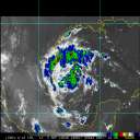
Is anyone watching? The eye, while apparently doing a wobble just almost wobbled "out of" the wind field to the west. Biggest wobble Ive ever seen. The eye is in the farthest southwest section of the wind field now lopping off the northern activity. Maybe the whole track will be moved west. Or maybe this is the start of the push to the south some models (i.e. BAMS) predicted.
(This watching the NOAA Eastern U.S. JSL Color Infrared Loop at 7:45 UTC)
|
ltpat228
Storm Tracker

Reged:
Posts: 201
Loc: Port Saint Lucie FL
|
|
I live on the east coast of Florida and for days we've had winds gusting to 35mph coming mainly from the east.
My roomate said he just read on AOL weather that these winds are coming from Ida.
I find that hard to believe.
Is this true?
|
MikeC
Admin
Reged:
Posts: 4692
Loc: Orlando, FL
|
|
Not ida directly, it's the gradient between high pressure to the north and the low (Ida) in the Gulf. Ida itself has its own wind energy north and east of the center. It's just going to be nasty all week with the combination of the two.
|
MichaelA
Weather Analyst

Reged:
Posts: 952
Loc: Pinellas Park, FL
|
|
Been breezy here in the Tampa Bay area for several days. I'm relaxing today since Ida is staying well to the west of my area. The only thing to watch for now is high surf conditions tomorrow as the wind becomes more onshore and the approach of the cold front which could bring the threat of thunderstorms/squalls on the back side of Ida.
--------------------
Michael
PWS
|
bammer
Unregistered
|
|
Is there any explanation, other than "her last gasp," for the apparent convective burst ongoing? And what are the ramifications for lower Alabama? Thanks.
|
Marknole
Weather Watcher

Reged:
Posts: 47
Loc: Wacissa, FL
|
|
Wanted to crow from my prediction back on Wednesday. I don't get too many of these right, and since we're looking at a diminishing threat, why not?:
Since we are looking at a system of questionable strength and organization when and if it re-emerges (early next week), there would likely be a digging trof that would shear and shred the circulation. After that, some areas would get bonus rainfall with the front that absorbs the remnants.
That being said, Tallahassee's last hurricane hit in November, (1985 - Kate), and tore this (inland) area up. Lots of big trees and branches in the State Capital...
|
Ed in Va
Weather Master
Reged:
Posts: 489
Loc:
|
|
Anybody give any credence to Bastardi's future track, which brings Ida off the SE coast and then bombing into a several day event hybrid storm? I will give him credit for his Fri/Sat prediction for a Cat 2 for Ida.
--------------------
Survived Carol and Edna '54 in Maine. Guess this kind of dates me!
|
berrywr
Weather Analyst

Reged:
Posts: 387
Loc: Opelika, AL
|
|
What remains of Ida is the small area of convection that now exists near the center and while it may be a hurricane briefly prior to landfall, the bulk of Ida is onshore as shear took its toll earlier today with the lone exception of that convective burst. Ida's center may in fact be tropical, but Ida's appearance on satellite is that of a subtropical cyclone as the non-tropical low to its west, incoming shortwave will begin to merge once Ida is onshore. I haven't looked at the 12Z model run but there was earlier discussion of a low "bombing" out off the coast of GA/SC as the next shortwave dives into the upper level trough just off the SE coast as flow aloft becomes NW.
--------------------
Sincerely,
Bill Berry
"Survived Trigonometry and Calculus I"
|
berrywr
Weather Analyst

Reged:
Posts: 387
Loc: Opelika, AL
|
|
This is the Model Diagnostic Discussion courtesy of HPC pertaining to Ida and future evolution of its remains::
MODEL DIAGNOSTIC DISCUSSION
NWS HYDROMETEOROLOGICAL PREDICTION CENTER CAMP SPRINGS MD
147 PM EST MON NOV 09 2009
VALID NOV 09/1200 UTC THRU NOV 13/0000 UTC
...SEE NOUS42 KWNO ADMNFD FOR THE STATUS OF THE UPPER AIR
INGEST...
12Z MODEL EVALUATION INCLUDING THE NEW AND FINAL PREFERENCES
INITIALIZATION ERRORS WITH THE NAM/GFS DO NOT APPEAR TO
SIGNIFICANTLY IMPACTS THEIR FORECASTS.
Excerpt follows:
PREFERENCE: 1/2 EACH /ECMWF
...HURRICANE IDA...
...INTERACTION OF IDA WITH SHORTWAVE TROUGH OVER TEXAS...
THE MAJORITY OF MODELS...INCLUDING THE NAM...ALLOW THE APPROACHING
SHORTWAVE TROUGH TO PULL IDA IN A NORTHWESTERLY DIRECTION UNTIL
THEY CONSOLIDATE NEAR THE GULF COAST BY 12Z TUE. HOWEVER...
THE LIES NEAR THE SOUTHWEST OR SLOW EDGE OF THE GUIDANCE
DURING THIS PROCESS AND IS CONSIDERED LEAST RELIABLE...WHILE ALL
OTHER GUIDANCE...INCLUDING THE /ECMWF ALLOW THE CONSOLIDATED
LOW TO DRIFT EASTWARD INTO THE FLORIDA PANHANDLE BY TUE...WHICH IS
IN GOOD AGREEMENT WITH HURRICANE MODEL GUIDANCE. REFER TO THE TPC
FOR THE OFFICIAL FORECAST.
...SHORTWAVE TROUGH AMPLIFYING OVER THE EAST TUE/WED...
PREFERENCE: 1/2 GEFS MEAN TO 1/4 EACH /CANADIAN
THERE HAS BEEN A NOTABLE TREND IN THE MAJORITY OF GUIDANCE THE
LAST DAYS TO DELAY A COMPLICATED PHASING PROCESS OF THIS
TROUGH WITH A SEPARATE SHORTWAVE TROUGH MOVING INTO THE SOUTHEAST
UNTIL BOTH TROUGHS REACH THE EAST COAST. THE AND MULTI-MODEL
ENSEMBLE MEANS WERE FIRST TO DISPLAY A LESS-PHASED OR UNPHASED
SOLUTION 1-2 DAYS AGO...WITH THE DETERMINISTIC GUIDANCE SLOWLY
COMING INTO AGREEMENT. THE NEW CONTINUES TO SHOW NO
PHASING...BUT IS MOSTLY DUE TO ITS SLOW OUTLIER SOLUTION IN THE
GULF...SO THE CAN NOT PHASE. MEANWHILE THE NEW HAS TRENDED
TOWARD SLOWER AND WEAKER PHASING...RESULTING IN A LESS PRONOUNCED
SURFACE LOW OFF THE GA/SC COAST...WITH REASONABLY GOOD SUPPORT
PROVIDED FROM THE CANADIAN AND GEFS MEAN...
ALBEIT WEAKER AND MORE SUPPRESSED THAN THE . THE /UKMET
NOW REMAIN THE ONLY DETERMINISTIC SOLUTIONS SUPPORTING
CONSIDERABLE SURFACE LOW DEVELOPMENT OFF THE SC COAST BY THU.
THUS...WILL MAINTAIN CONTINUITY WITH PRIOR REASONING THAT THE
POSITIVELY-TILTED LONGWAVE PATTERN AND ITS SUBSEQUENT SHORTWAVE
PATTERN SUPPORT A SUPPRESSED AND PROGRESSIVE SURFACE LOW
EVOLUTION...WHICH IS CLOSEST TO THE GEFS MEAN.
...MODEL TREND GRAPHICS AT
www.HPC.NCEP.NOAA.GOV/HTML/MODEL2.SHTML...
...500 MB FORECASTS AT
www.HPC.NCEP.NOAA.GOV/H5PREF/H5PREF.SHTML...
--------------------
Sincerely,
Bill Berry
"Survived Trigonometry and Calculus I"
|


 Threaded


