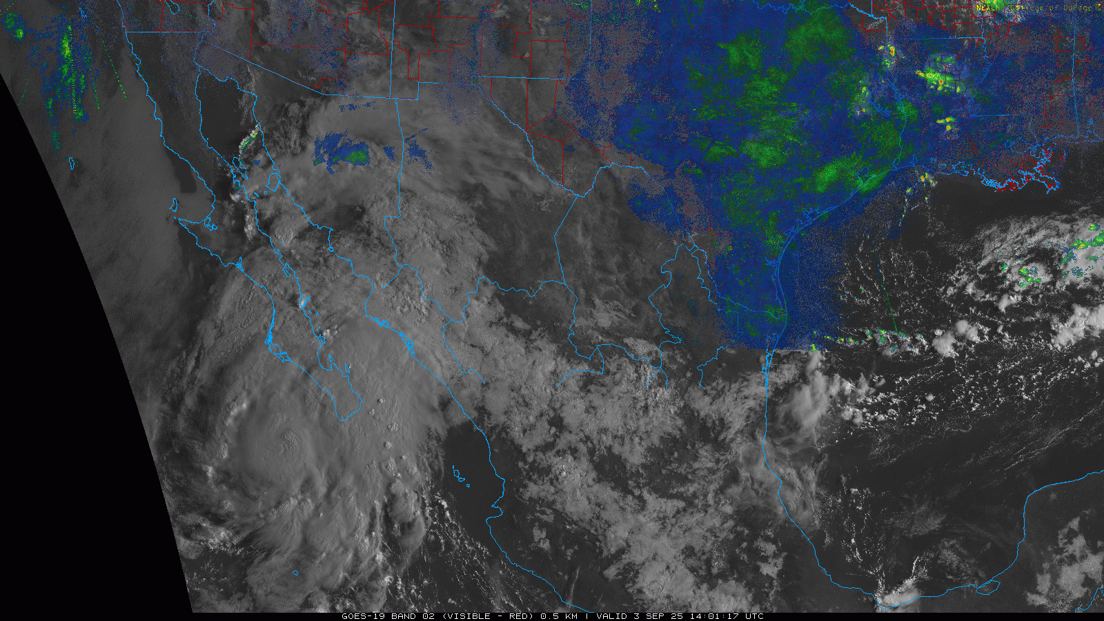
Eastern Pacific Lorena has become a hurricane and continues to enjoy conditions favorable for continued strengthening. As such, models that have predicted a deeper and more coherent cyclone (GFS, HWRF, HMON, HAFS, others), which thus also strongly favor a track towards into and potentially across mainland northwestern Mexico are now much more in play and likely to verify than those that predicted a shallower, weaker system with a track either west out to colder water/dissipating near or over the Baja (ECMWF, GDPS, ICON, others).
Considering the potential for significant water impacts to portions of the southwestern US, we are now starting a de facto Other Storm Basins "Lounge" on Hurricane Lorena.
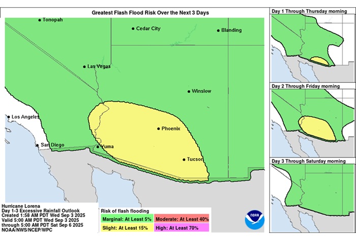
Excessive Rainfall Discussion
NWS Weather Prediction Center College Park MD
1135 AM EDT Wed Sep 3 2025
Day 1
Valid 16Z Wed Sep 03 2025 - 12Z Thu Sep 04 2025
...THERE IS A SLIGHT RISK FOR EXCESSIVE RAINFALL FOR PORTIONS OF SOUTHERN ARIZONA...
...Southwest...
16Z Update: 12Z CAMs have reasonable continuity from the previous forecast leading to similar probs based off the latest 12Z HREF. Highest threat will be over Santa Cruz and Pima counties with the northern edge brushing southern Pinal and Maricopa. 12Z KPSR sounding came in with a 1.47" PWAT, enough for a 90th percentile climo with higher PWATs forecasted south of Phoenix. This environment is plenty reason for any cell maturation to produce
locally 1-2"/hr rates that could spell problems for any of the desert locations south of I-10. For this reason, there were only some minor adjustments overall to the inherited SLGT risk with a touch further north extension to match trends in QPF from the latest CAMs.
Kleebauer
..Previous Discussion..
A broad area of instability and above normal moisture will bring a localized flash flood risk to much of the southwestern U.S. today. HREF guidance indicates the best convective coverage will be across southern AZ where neighborhood probabilities of 2"+ amounts are 30-50%. This generally looks to be where the better instability is forecast today, and also where the heaviest rainfall occurred yesterday. Thus maintaining the Slight risk across this areas seems reasonable.


 Threaded