cieldumort
Moderator

Reged:
Posts: 2896
Loc: Austin, Tx
|
|
A roughly eight day window for development in the Gulf is starting to get a lot more hits from extended range quality models and their ensembles. It is not immediately clear if this will be from a Central American Gyre, wave, or combination of both, but the general region of projected best genesis potential seems to favor either or both. The signal has been consistent, with the stellar Google DeepMind FNv3 now implying 40% odds of development from the western Caribbean into the Gulf during this window. Given the very consistent signal, we are starting a Lounge on this projected system, Invest TBD, at this time.
It is worth noting that 2026 has not seen a hurricane form yet in the Atlantic basin and the current El Niño has been much stronger than forecasts prior to the start of the season. In fact, this El Niño is setting all-time records going back at least decades and likely centuries. Given that we do not have much historical precedent to work off of as far as how this could influence modeling this far out, some consideration should be given that they could be overcooking things. Nonetheless, here are some examples:
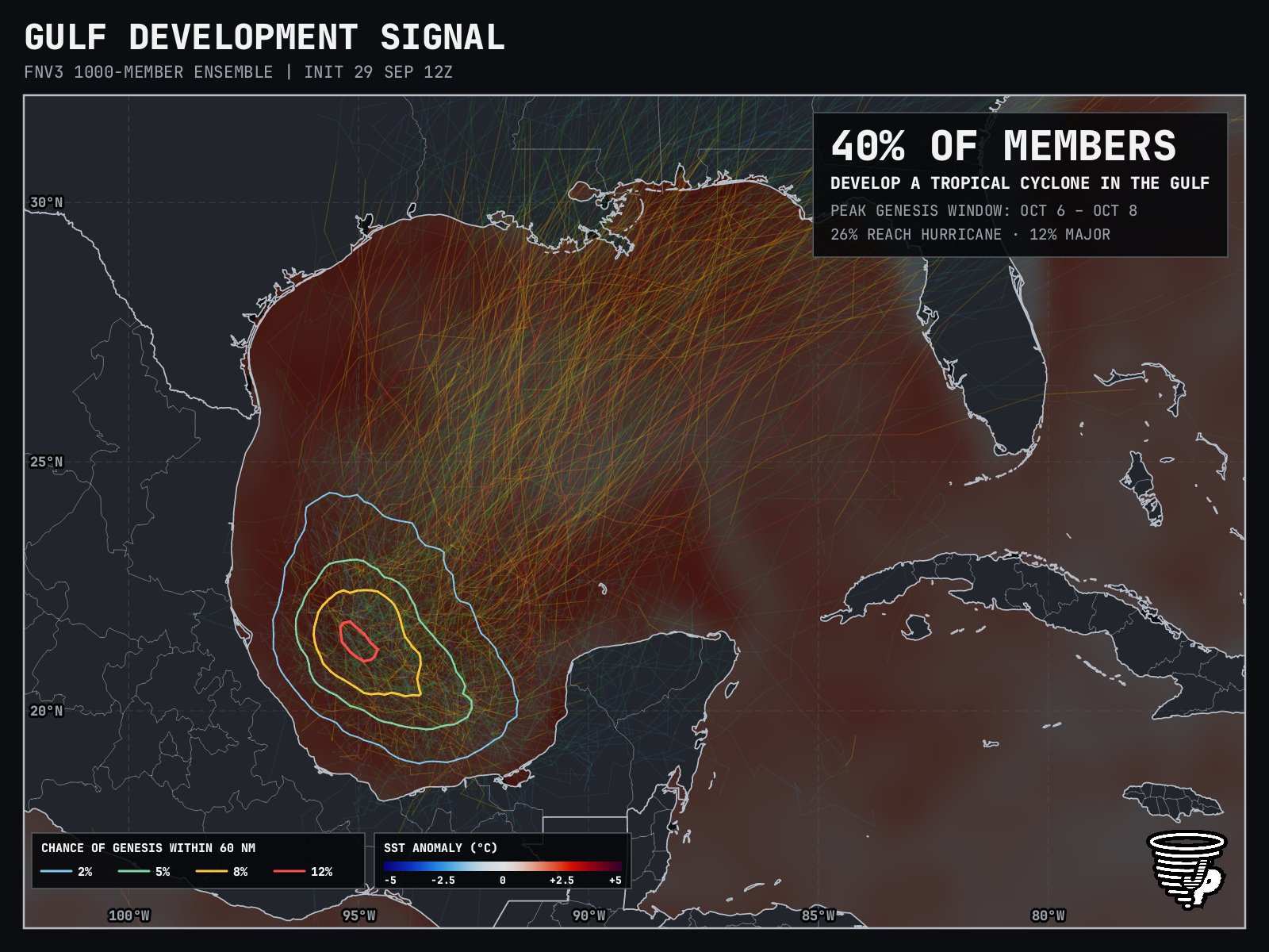
Image credit: James Pettus @PettusWX pettusplots.com
The most recent DeepMind generation, WNv3, is not as impressed, at 22% development odds. Timeline is about the same, with median genesis 228 hours from 12Z today (0z Oct 9)
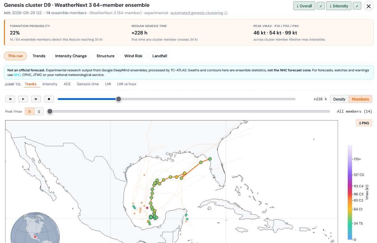
Credit: TC-ATLAS
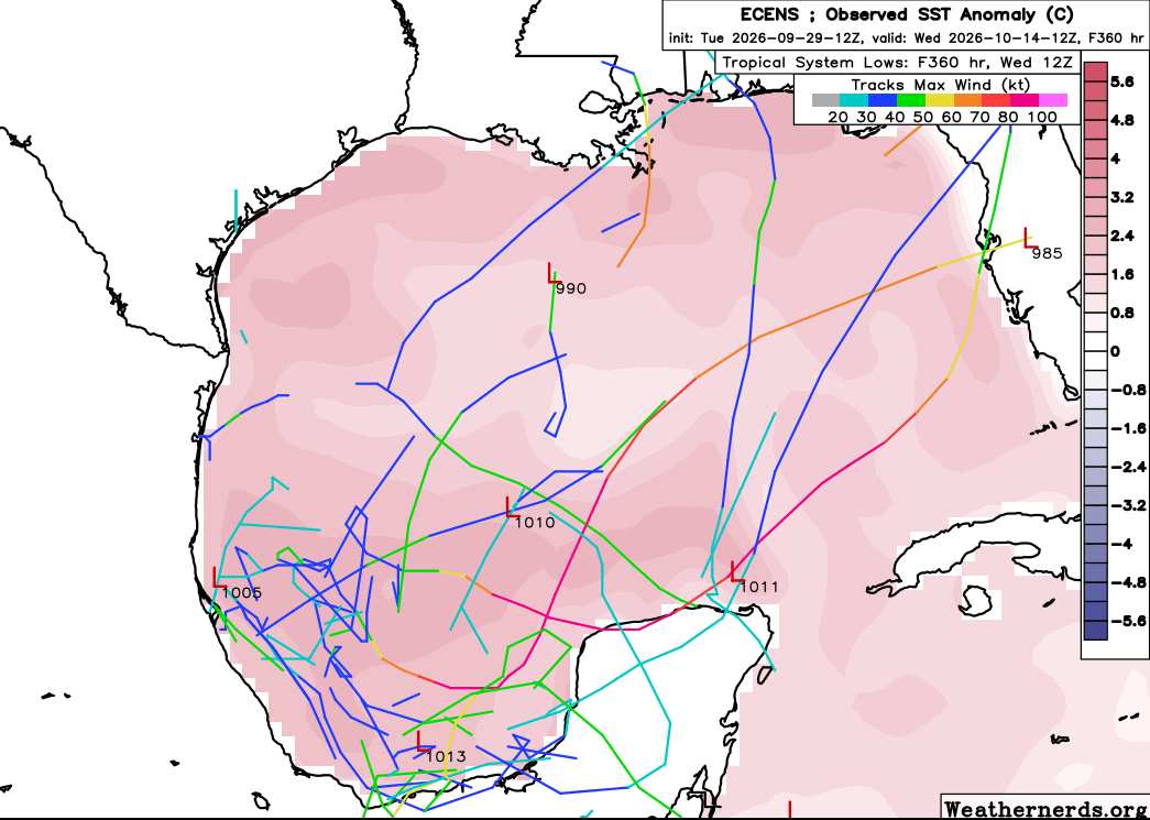
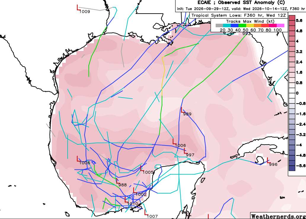
|
cieldumort
Moderator
Reged:
Posts: 2896
Loc: Austin, Tx
|
|
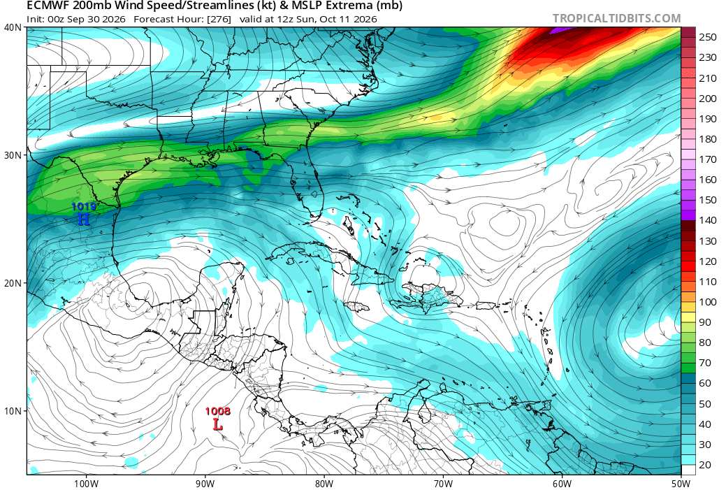
In general, this window favors development from all the usual suspects in and around the Gulf. However, anything that might want to form from a front in the northern Gulf could just trend more subtropical or at the very least sheared/struggling, while anything that might want to form in the Bay of Campeche (Central American Gyre-born/EPac crossover/tropical wave) looks to have much better odds of being purely tropical with potentially a higher intensity ceiling. Upper level winds/lift forecast to become quite favorable over the BOC during the middle of this window, as can be seen below.
|
|



 Previous
 Index
Index
 Next
Next
 Threaded


 Edit
Edit
 Reply
Reply
 Quote
Quote


