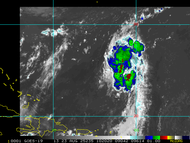
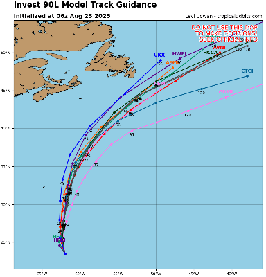
Hurricane Melissa Approaches Jamaica
Posted: 05:13 PM 25 October 2025 | 8 Comments | Add Comment | Newest: 05:15 PM 28-Oct EDT
Melissa is exiting northwestern Jamaica, now no longer a high-end Major hurricane, but a hurricane that is growing in size. Some restrengthening is also forecast, and eastern Cuba and the southeastern and central Bahamas should be rushing their preps to protect life and property to completion.
Ciel
11:00AM EDT 28 October 2025 Update
Melissa has become one of planet earth's top strongest landfalls in all of recorded history, having continued to intensify into landfall.
Now conservatively 185 MPH, pressure down to 892mb.
NHC Update Text:
Quote:
...EXTREMELY DANGEROUS CATEGORY 5 MELISSA ABOUT TO MAKE LANDFALL IN JAMAICA...
...CATASTROPHIC WINDS, FLASH FLOODING, AND STORM SURGE OCCURRING ON THE ISLAND...
SUMMARY OF 1100 AM EDT...1500 UTC...INFORMATION
-----------------------------------------------
LOCATION...17.9N 77.9W
ABOUT 40 MI...60 KM SE OF NEGRIL JAMAICA
ABOUT 235 MI...380 KM SW OF GUANTANAMO CUBA
MAXIMUM SUSTAINED WINDS...185 MPH...295 KM/H
PRESENT MOVEMENT...NNE OR 25 DEGREES AT 9 MPH...15 KM/H
MINIMUM CENTRAL PRESSURE...892 MB...26.34 INCHES
WATCHES AND WARNINGS
--------------------
CHANGES WITH THIS ADVISORY:
The Government of Cuba has issued a Hurricane Warning for the province of Las Tunas and a Tropical Storm Warning for the province of Camaguey.
The Meteorological Service of the Bahamas has discontinued the Hurricane Watch for the Turks and Caicos islands.
SUMMARY OF WATCHES AND WARNINGS IN EFFECT:
A Hurricane Warning is in effect for...
* Jamaica
* Cuban provinces of Granma, Santiago de Cuba, Guantanamo, Holguin, and Las Tunas
* Southeastern and Central Bahamas
A Tropical Storm Warning is in effect for...
* Haiti
Ciel
11:00PM EDT 27 October 2025 Update
NHC Key Messages:
Quote:
1. Jamaica: Remain in your safe shelter. Catastrophic flash flooding and numerous landslides are expected through Tuesday. The eyewall’s destructive winds may cause total structural failure, particularly in higher elevations, leading to widespread infrastructural damage, prolonged power and communication outages, and isolated communities. Along the southern coast, life-threatening storm surge and damaging waves are anticipated through Tuesday. Failure to take immediate action may result in serious injury or significant loss of life.
2. Haiti and the Dominican Republic: Catastrophic flash flooding and landslides are expected across southwestern Haiti and southern portions of the Dominican Republic through midweek. In Haiti, extensive infrastructural damage and isolation of communities is likely. Tropical storm conditions are expected late Tuesday and Wednesday.
3. Eastern Cuba: Heavy rainfall with life-threatening flash flooding and landslides is expected to begin shortly. Life-threatening storm surge and damaging winds are expected late Tuesday and Tuesday night. Preparations should be rushed to completion.
4. Southeast and Central Bahamas and the Turks and Caicos: Hurricane conditions, life-threatening storm surge, and heavy rainfall are expected across portions of the southeast and central Bahamas on Wednesday. Residents should follow advice given by local officials and be sure to have preparations complete by Tuesday night. Tropical storm conditions, heavy rains, and a significant storm surge is expected in the Turks and Caicos Islands on Wednesday.
Ciel
10:00PM EDT 27 October 2025 Update
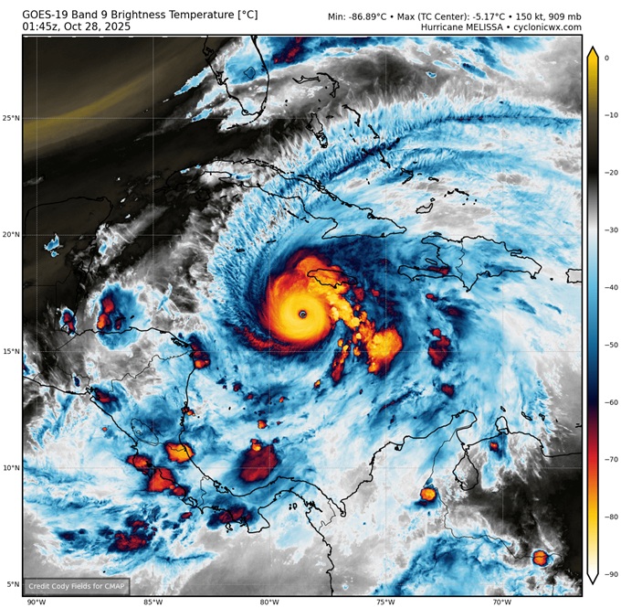
Melissa has resumed tracking north-northeast, but unlike a few days ago, this motion this time could also favor additional strengthening, however unbelievably so.
Melissa is now over some of the warmest, and deeply warmest, waters of the entire world, having tracked west of a (relatively) 'cooler' (less warm) eddy that is now to the cyclone's east. At the same time, the approaching trof that will ultimately sweep her up, is creating a very favorable outflow (exhaust) channel. It is not inconceivable that Melissa generally maintains or even intensifies further into landfall, save hard-to-foresee dynamics such as Eyewall Replacement Cycles. At a minimum, the hurricane appears to be strengthening further tonight.
Ciel
8:45PM EDT 27 October 2025 Update
Melissa continues tracking a touch west/west-southwest of forecast. Essentially, the more Melissa tracks w/sw/s, the more favorable environment for intensification the cyclone encounters. The stronger the cyclone gets, the more it feels the west-southwestward shove of the high pressure that is draped across to its north/northeast. Rinse. Repeat. While this is unlikely to continue forever, as a scouring trof is pushing off the CONUS that will most likely sweep Melissa up to the north-northeast, the hurricane is getting more time in even more favorable conditions, with a greater portion of Jamaica only now more likely to be in the typically worst Right Front Quadrant. Not ideal.
All this was discussed in our Melissa Forecast Lounge a few times. The Lounge is where we continue to do some deeper dives into modeling and more with Melissa.
Ciel
2:00PM EDT 27 October 2025 Update
Melissa is setting records. In fact, it appears that Melissa may now have the driest eye ever recorded on planet earth.
The 2PM NHC update pegs Melissa's maximum sustained winds at 175 MPH at the surface, but recon and satellite yet again support higher.
Recon recently measured winds at 1,000' above sea level of 240 MPH in the Right-Front-Quadrant (RFQ). Based on the current forecast track, locations on the mountainous island of Jamaica in the hurricane-force radii and within the RFQ may very well experience these winds, and several of these spots are well-populated.
Taking Mandeville as an example. According to Wikipedia, "Mandeville is the capital and largest town in the parish of Manchester in the county of Middlesex, Jamaica. In 2005, the town had an estimated population of 50,000, and including the immediate suburbs within a radius of 16 km the total population was about 72,000." Mandeville's elevation is roughly 2,000' above sea level.
11:00AM EDT 27 October 2025 Update
NHC goes with 165MPH as of the 11AM update today. This could be conservative. Recon data supports higher, and much higher at elevated locations a few hundred feet up, which are certain to impact portions of the island they cross with gusts well over 200 MPH.
On its current forecast track, Jamaican locations within about a 20 mile radius of the eye are likely to be laid in waste, unrecognizable and unlivable for weeks, possibly months, and in some places, potentially years. Flash flooding and land/mudslides will also do a number on areas even outside of the hurricane-force wind radii. Sheltering outside of locations known to be prone to flash flooding and landslides is recommended.
Ciel
5:30AM EDT 27 October 2025 Update
2025 just hit a massive milestone with Melissa becoming the third Category 5 of the year, putting 2025 only behind 2005 for numbers of Category Fives in any one season.
Recon has found pressures down to 917mb, still falling. Recon has also found winds arguably supportive of higher than the 5AM Advisory of 160MPH, still increasing. In fact, a dropsonde found the mean wind in the lowest 150 meters to be 180 MPH. Even a little higher speed than that was recorded at the proxy surface. Thus, the 5AM Adv #24 could be conservative.
It cannot be overstated how potentially dangerous Melissa is. Efforts to protect life and property should be rushed to completion in warned zones.
NHC
Quote:
...DESTRUCTIVE WINDS AND STORM SURGE AND CATASTROPHIC FLOODING WILL WORSEN ON JAMAICA THROUGH THE DAY AND INTO TONIGHT...
WATCHES AND WARNINGS
--------------------
CHANGES WITH THIS ADVISORY:
The government of the Bahamas has issued a Hurricane Watch for the central and southeastern Bahamas and the Turks and Caicos Islands.
SUMMARY OF WATCHES AND WARNINGS IN EFFECT:
A Hurricane Warning is in effect for...
* Jamaica
* Cuban provinces of Granma, Santiago de Cuba, Guantanamo, and Holguin.
A Hurricane Watch is in effect for...
* Southeastern and central Bahamas
* Turks and Caicos Islands
A Tropical Storm Warning is in effect for...
* Haiti
* Cuban province of Las Tunas
Ciel
12:30PM EDT 26 October 2025 Update
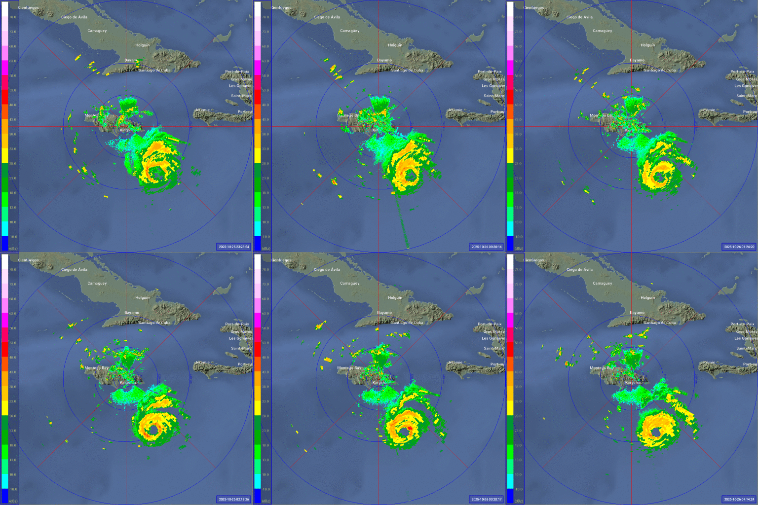
Melissa ended her southwesterly motion this morning and is now tracking generally west to west-northwest, possibly running headstrong into a little more shear, while also having ended her overnight DMAX cycle. These external and internal forces could be resulting in what is shown on radar out of Kingston, Jamaica, to be an open eyewall and some hints of the possible beginnings of an Eyewall Replacement Cycle (ER). Whatever the reasons, for the time being, Melissa has stopped intensifying, but remains an extremely powerful and dangerous Category Four MAJOR.
Melissa is not a hurricane to second guess in a year that, while so far very lucky for most in terms of landfalls, has still more or less kept up with the theme of the Atlantic basin since 1995. In fact, together with 2025's previous Majors (Gabrielle, Humberto and Erin), 2025 now ties with only 2005, 2008 and 2020 for the most 50+ knot RI events in a season (4): Gabrielle, Humberto, Erin and now Melissa. h/t Kieran Bhatia
SUMMARY OF WATCHES AND WARNINGS IN EFFECT AS OF THIS UPDATE:
A Hurricane Warning is in effect for
* Jamaica
A Hurricane Watch is in effect for
* Southwestern peninsula of Haiti from the border with the Dominican Republic to Port-Au-Prince
* Cuban provinces of Granma, Santiago de Cuba, Guantanamo, and Holguin.
A Tropical Storm Warning in effect for...
* Southwestern peninsula of Haiti from the border with the Dominican Republic to Port-Au-Prince
Ciel
Original Update
Melissa is now a hurricane and has a rare forecast calling for a Category 5 major hurricane before landfall, impacts will start to pick up tomorrow and increase in intensity rapidly Monday and landfall possibly early Tuesday morning in the pre-dawn areas somewhere in Jamaica.
If the forecast is correct, it will be the strongest hurricane to impact Jamaica since records began. ;
Active Jamaica Radar Loop:
Melissa Event Related Links
Tropical Tidbits Page on system
Flhurricane Satellite Floater Animation of Melissa
GOES Floater
Tomer Berg Info page for Melissa
CyclonicWx Page for Melissa
Clark Evans Track Model Plot of Melissa
(Animated!) Model Plots in Google Earth - In Google Maps
Clark Evans Intensity Model Plot of Melissa (Animated!)
Clark Evans Track Plot of Melissa
Clark Evans Top 10 Analog Storms for Melissa
http://www.ral.ucar.edu/guidance/realtime/current/ More model runs on from RAL/Jonathan Vigh's page
NRL Info on Melissa -- RAMMB Info
COD Atlantic Satellite View
StormCarib Reports from the Caribbean Islands
Caribbean Weather Observations
Full Caribbean Radar Composite
Caribbean Broadcast Corporation (TV/Radio from Antilles)
Jamaica Storm Info/Media
Jamaican Meteorological Service
Jamaica Office of Disaster Preparedness & Emergency Management
Bermuda Newspapers/Media/Info:
Jamaica Live Cameras
Timelapses and more from Jamiaca
Jamaica Power Outage map
Melissa in the Caribbean
Posted: 01:18 PM 18 October 2025 | 5 Comments | Add Comment | Newest: 07:14 PM 24-Oct EDT
Melissa has a chance to intensify rapidly enough to track further west upon feeling the new steering currents, but would be doing so from a point now further east than forecast, due to center relocations earlier today. As a result, the 5PM Advisory now has Melissa, as a borderline Cat 5, tracking directly across Jamaica.
It is important to stress that even if a direct path across Jamaica does not occur, Melissa's increased size and slow forward speed will almost certainly result in profoundly catastrophic flash flooding and mudslides, regardless of the maximum wind speeds on land. Preparations to protect life and property from flooding and mudslides should be every bit as important as protecting from the wind.
NHC:
Quote:
Key Messages:
1. Jamaica: Due to Melissa’s slow motion, a prolonged multi-day period of damaging winds and heavy rainfall resulting in potentially catastrophic flash flooding and numerous landslides is likely to begin late Saturday or Sunday. There is an increasing risk of life-threatening storm surge when the center of Melissa nears Jamaica early next week. Preparations to protect life and property should be rushed to completion.
2. Haiti: Heavy rainfall will result in catastrophic flash flooding and landslides across southwestern Haiti into early next week. Extensive damage to roads and buildings is expected, potentially isolating communities for an extended period of time. Immediate preparations to protect life and property should be taken. Strong winds could also potentially last for a day or more over the Tiburon peninsula of Haiti.
3. Dominican Republic: Heavy rainfall could produce potentially catastrophic flash flooding and numerous landslides in southern portions of the Dominican Republic.
4. Eastern Cuba and Bahamas: Interests in Cuba and the Bahamas should monitor the progress of Melissa since there is an increasing risk of significant storm storm surge, damaging winds, and heavy rainfall by the middle of next week. The risk of life-threatening flash flooding and landslides in eastern Cuba are increasing.
Ciel
2:00AM EDT 24 October 2025 Update
The forecast for Melissa is one of the trickiest and least straight forward the NHC has had to do in quite some time. Even with multiple recon missions, so many competing forces and variables being at play have made certain details of lower confidence. However, what is not of low confidence, is that Melissa is not a tropical cyclone to roll the dice on. Taking a personal liberty here to ask our friends in and around Jamaica and Haiti to do everything possible to prepare for the worst and hope for the best. The potential for Melissa to become one of the most catastrophic hurricanes in the Atlantic basin so far this century can not be overstated.
Ciel
11:30PM EDT 23 October 2025 Update
Tropical Storm Melissa is forecast to make a multi-day major blow to Jamaica, with a fairly grim forecast that would impact the island with mulltiple days of extremely heavy rain, winds, and storm surge, across the entire island, and with most of the surge being on the south side of the island. (entire length of it) Those there please take it seriously.
the key messages states it best. Due to Melissa’s slow motion, the risk of a prolonged multi-day period of potentially damaging winds, heavy rainfall resulting in life-threatening flash flooding and numerous landslides, and storm surge continues to increase for Jamaica. Preparations to protect life and property should be rushed to completion, since strong winds and flooding rains could begin in Jamaica by Saturday.
Beyond this, eastern Cuba, including Guantanamo bay, and the Bahamas will need to watch, as well as eventually Bermuda.
2:30PM EDT 22 October 2025 Update
Melissa has once again proceeded west, which puts the center effectively a little southwest of where it was expected at this time, and would have to
shoot a touch northeast to realign, which is possible with a center jump, but until then, once again, Melissa is southwest of forecast.
Quote:
At 200 PM EDT (1800 UTC), the center of Tropical Storm Melissa was located by Air Force Reserve reconnaissance aircraft near latitude 14.3 North, longitude 74.0 West. Melissa is moving slowly toward the west near 2 mph (4 km/h). (NHC)
The chance for the quicker northeast across Hispaniola and out-to-sea track continues diminishing, with the risk of a meander in the central-western Caribbean and becoming a high-end Major hurricane, producing rounds and rounds of rainfall for affected nearby landmasses, increasing.
Ciel
11:00AM EDT 22 October 2025 Update
Melissa is now officially forecast to become a Major Hurricane, and very slow moving, in the central to western Caribbean. Interests in this region should begin considering taking necessary precautions to protect life and property, as this set up is particularly conducive to a high-end tropical cyclone that gets its name retired.
Ciel
10:30AM EDT 21 October 2025 Update
Invest 98L has become Tropical Storm Melissa
WATCHES AND WARNINGS
A Hurricane Watch has been issued for the southern peninsula of Haiti from the border with the Dominican Republic to Port-Au-Prince. The government of Jamaica has issued a Tropical Storm Watch for the island.
Ciel
2:30AM EDT 21 October 2025 Update
Advisories are expected to begin at any time today for either Potential Tropical Cyclone, or more likely still, Tropical Storm Melissa.
WARNINGS
...CARIBBEAN GALE WARNING...
Caribbean within 15N68W to 15N69W to 15N70W to 14N68W to 15N68W E to SE winds 30 to 35 KT. Seas 2.5 to 3.0 M.
The Meteorological Service of Jamaica has issued a Severe Weather Alert for the entire island, effective until 5 p.m. on Thursday.
Ciel
8:00PM EDT 20 October 2025 Update
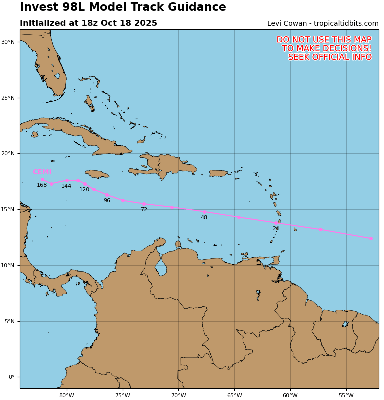
NHC has increased their 2-day development probability that 98L becomes a TC to 90%. Watches and Warnings for locations in the Caribbean could be coming as soon as overnight tonight. Regardless of imminent Watches/Warnings, portions of the ABC Islands can expect heavy rain and strong wind gusts the next few days. Puerto Rico, Hispaniola, Jamaica and Cuba could be looking at even more significant impacts, including the possibility of extreme rainfall totals and very high winds by mid to late week.
The next name on the list this year is Melissa. There is a very real possibility that this system, should it become Melissa as is very likely, gets retired. Interests around the Caribbean should begin considering paying very close attention, monitoring reliable local advisories and forecasts, and keeping abreast of updates from the National Hurricane Center.
Ciel
1:45AM EDT 19 October 2025 Update
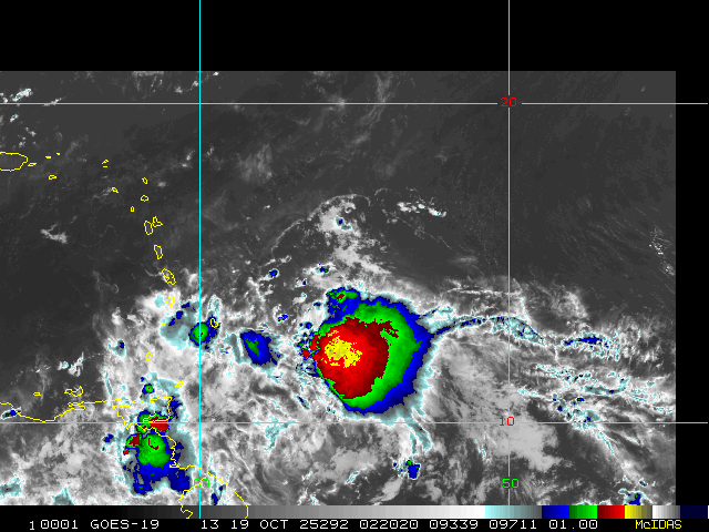
Invest 98L appears to be ramping up tonight.
During the last few frames of daylight satellite imagery, a little LLC could be seen, which could also now be getting nestled underneath persistent deep convection. Additionally, recent scatterometer data shows surface winds likely gusting well into tropical storm force in portions of its eastern side.
Interests in the Lesser Antilles may want to consider making some initial preps for what could be a very stout wave, or even perhaps, if the wave can close off prior to or during passage into the Caribbean, a bona fide tropical storm. TC genesis still looks much more possible once it is in the central to western Caribbean owing to its current fast forward speed, but the chance of development prior to reaching the Caribbean may be going up.
Ciel
Original Update
With occluding fronts rolling into the subtropics and tropical waves still rolling into the tropics, opportunities for development continue into the second half of this back-loaded 2025 Atlantic Hurricane Season. One silver lining, climatology increasingly disfavors mainland US landfalls from October on. However, this is not the case for locations in and around the Caribbean, nor for Bermuda, and systems are still deserving to be watched.
The most impressive wave of two we have been tracking for some time now has just been Invest tagged, 98L. The wave ahead of it also has a chance to develop, but appears to be less than 98's. Interests in and around the Caribbean may want to begin paying closer attention to both of these waves.
Model deep dives and speculation on 98L/Melisssa: Melissa Forecast Lounge
Melissa Event Related Links
Tropical Tidbits Page on system
Flhurricane Satellite Floater Animation of Melissa
GOES Floater
Tomer Berg Info page for Melissa
CyclonicWx Page for Melissa
Clark Evans Track Model Plot of Melissa
(Animated!) Model Plots in Google Earth - In Google Maps
Clark Evans Intensity Model Plot of Melissa (Animated!)
Clark Evans Track Plot of Melissa
Clark Evans Top 10 Analog Storms for Melissa
http://www.ral.ucar.edu/guidance/realtime/current/ More model runs on from RAL/Jonathan Vigh's page
NRL Info on Melissa -- RAMMB Info
COD Atlantic Satellite View
StormCarib Reports from the Caribbean Islands
Caribbean Weather Observations
Full Caribbean Radar Composite
Caribbean Broadcast Corporation (TV/Radio from Antilles)
Jamaica Storm Info/Media
Jamaican Meteorological Service
Jamaica Office of Disaster Preparedness & Emergency Management
Jamaica Live Cameras
Timelapses and more from Jamiaca
Jamaica Power Outage map
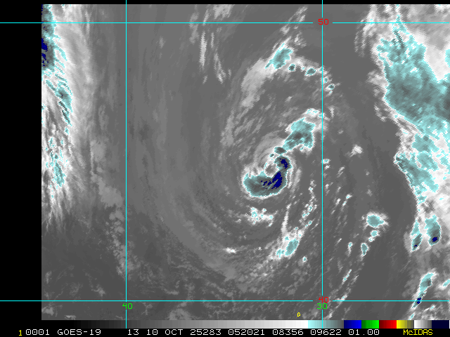
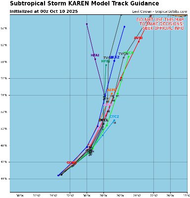
Invest 96L in the far northern Atlantic has become Subtropical Storm Karen. Karen is very much a fish spinner, presently near 44.5N 33W, also unlikely to add much at all to seasonal ACE, but does qualify as a legitimate name in this back-loaded 2025.
Ciel
10:45AM EDT 9 October 2025 Update
Jerry has been a little weaker and less organized that forecast, which may help explain why the storm continues to track southwest of consensus and the official line. But that is not to say that Jerry is weak. Tropical Storm conditions on portions of the Leeward Islands is becoming increasingly likely. The government of Antigua and Barbuda has issued a Tropical Storm Warning for Barbuda.
Ciel
10:50PM EDT 7 October 2025 Update
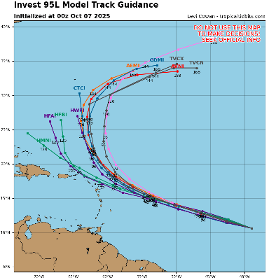
Tropical Storm Jerry has formed from a wave we have been tracking for some time, and is now officially forecast to brush the northern Leeward Islands. While confidence in a "recurve" out to sea is fairly strong, just when that turn happens and by how much of an angle is less so, and even a little deviation to the south of the NHC cone may bring strong tropical storm or even hurricane conditions to these islands, or at least just off their coasts.
Tropical Storm Watches are up for much of this area, and the USVI and Puerto Rico also should monitor.
NHC:
Quote:
SUMMARY OF WATCHES AND WARNINGS IN EFFECT:
A Tropical Storm Watch is in effect for...
* Antigua, Barbuda, and Anguilla
* St. Kitts, Nevis, and Montserrat
* St. Barthelemy and St. Martin
* Sint Maarten
* Saba and St. Eustatius
* Guadeloupe and the adjacent islands
Interests elsewhere in the northern Leeward Islands, and the British and U.S. Virgin Islands should monitor the progress of Jerry.
Elsewhere, a very low risk NHC 10% lemon outline exists over the Bay of Campeche for the next 48 hours or so, probably a blustery rain-maker in northeastern Mexico, and in the eastern Pacific, remnant moisture and energy from Hurricane Priscilla will likely bring scattered to numerous showers and thunderstorms to the southwestern US later this week into early next week, and last but not least, off the southeast coast, a non-tropical low could become a powerful Nor'easter of the liquid variety over the weekend.
Ciel
Original Update
The month of October has kicked off with a few weak lows in the Gulf and east of Florida that struggled and faded away due to high shear. So far, the CONUS has remained protected for most of this year, fortunately.
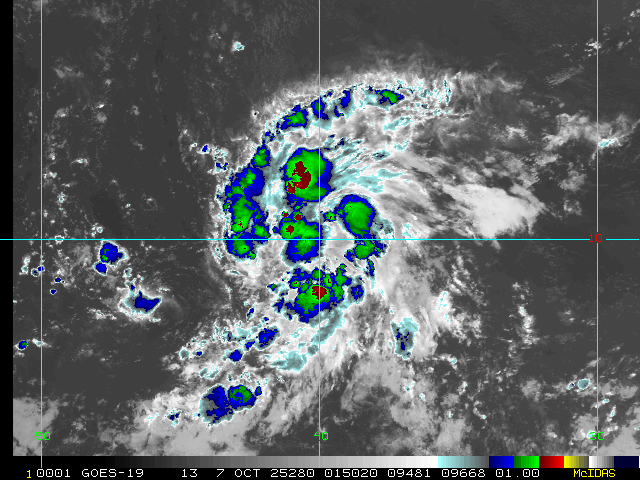
Out in the eastern Atlantic, we are watching what is now Invest 95L. This disturbance is widely expected by models to become our next named storm and could be something for the Antilles to keep an eye on late next week. A Forecast Lounge is available for this feature: 95L Forecast Lounge
Jerry Event Related Links
Tropical Tidbits Page on system
Flhurricane Satellite Floater Animation of Jerry
GOES Floater
Tomer Berg Info page for Jerry
CyclonicWx Page for Jerry
Clark Evans Track Model Plot of Jerry
(Animated!) Model Plots in Google Earth - In Google Maps
Clark Evans Intensity Model Plot of Jerry (Animated!)
Clark Evans Track Plot of Jerry
Clark Evans Top 10 Analog Storms for Jerry
http://www.ral.ucar.edu/guidance/realtime/current/ More model runs on from RAL/Jonathan Vigh's page
NRL Info on Jerry -- RAMMB Info
COD Atlantic Satellite View
Karen Event Related Links
Tropical Tidbits Page on system
Flhurricane Satellite Floater Animation of Karen
GOES Floater
Tomer Berg Info page for Karen
CyclonicWx Page for Karen
Clark Evans Track Model Plot of Karen
(Animated!) Model Plots in Google Earth - In Google Maps
Clark Evans Intensity Model Plot of Karen (Animated!)
Clark Evans Track Plot of Karen
Clark Evans Top 10 Analog Storms for Karen
http://www.ral.ucar.edu/guidance/realtime/current/ More model runs on from RAL/Jonathan Vigh's page
NRL Info on Karen -- RAMMB Info
COD Atlantic Satellite View
Invest 97L Event Related Links
Tropical Tidbits Page on system
Flhurricane Satellite Floater Animation of 97
GOES Floater
Tomer Berg Info page for 97
CyclonicWx Page for 97
Clark Evans Track Model Plot of 97
(Animated!) Model Plots in Google Earth - In Google Maps
Clark Evans Intensity Model Plot of 97 (Animated!)
Clark Evans Top 10 Analog Storms for 97
http://www.ral.ucar.edu/guidance/realtime/current/ More model runs on from RAL/Jonathan Vigh's page
NRL Info on 97 -- RAMMB Info
COD Atlantic Satellite View
StormCarib Reports from the Caribbean Islands
Caribbean Weather Observations
Full Caribbean Radar Composite
Caribbean Broadcast Corporation (TV/Radio from Antilles)
Humberto and Imelda
Posted: 11:43 AM 26 September 2025 | 2 Comments | Add Comment | Newest: 08:49 AM 30-Sep EDT
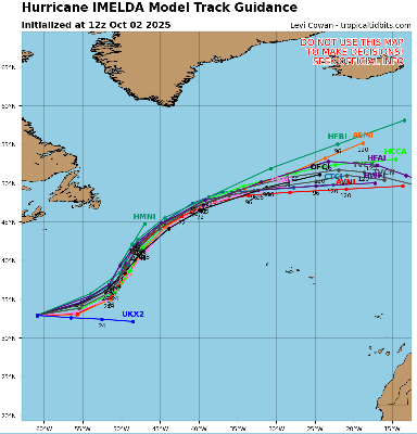
Overnight, Imelda continued to organize deep convection despite nearby dry air and occasional dry air intrusions, and has become a stout Cat 1 hurricane. Further strengthening is probable and forecast, although not assured. There is a fair chance of significant strengthening now that Imelda is better organized and could fight off shear and dry air for a while as it tracks towards Bermuda, which all guidance has in its sights between 36-48 or so hours from now. The Hurricane Watch for Bermuda could soon become a Hurricane Warning.
Ciel
5AM EDT 28 September 2025 Update
More northerly motion has begun on TD#9 and the models have finally reached a decent consensus, which matches the current forecast track. T#9 is forecast to stay east of Florida (some areas along the east coast may see some squally weather) and make a hard right turn out to sea probably around Daytona and follow Humberto out to sea. Bermuda should watch, but the risk to the southeast ts rapidly decreasing.
11AM EDT 27 September 2025 Update
Tropical Depression Nine has formed.
A Tropical Storm Watch has been issued for the east coast of Florida from the Palm Beach/Martin County Line northward to the Flagler/Volusia County Line.
from discussion:
Given the risk of tropical-storm-force winds along the east coast of
Florida, a Tropical Storm Watch has been issued from the Palm
Beach/Martin County Line northward to the Flagler/Volusia County
Line. Although it is still too early to specify the details of
potential impacts along the remainder of the southeast U.S. coast,
there remains a risk of heavy rainfall, storm surge, and wind
impacts.
10AM EDT 27 September 2025 Update
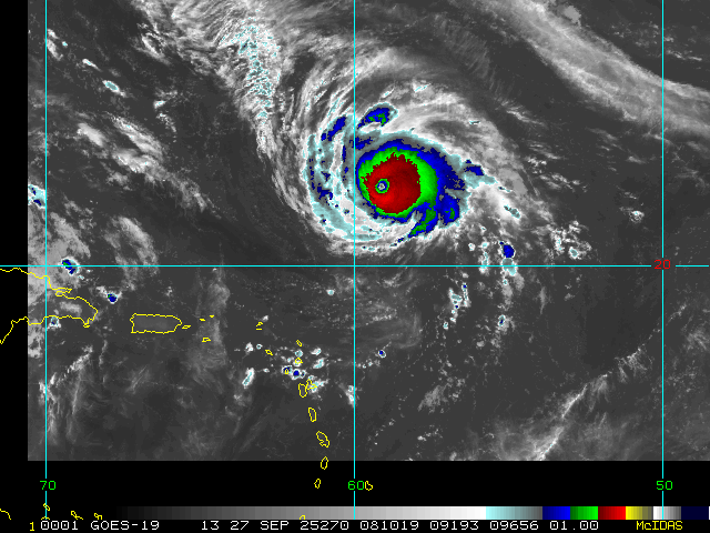
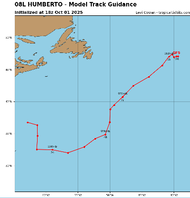
Humberto is now a powerful category 4 hurricane and is forecast to become a 5, the cone takes it north of Bermuda, but those there should monitor it closely.
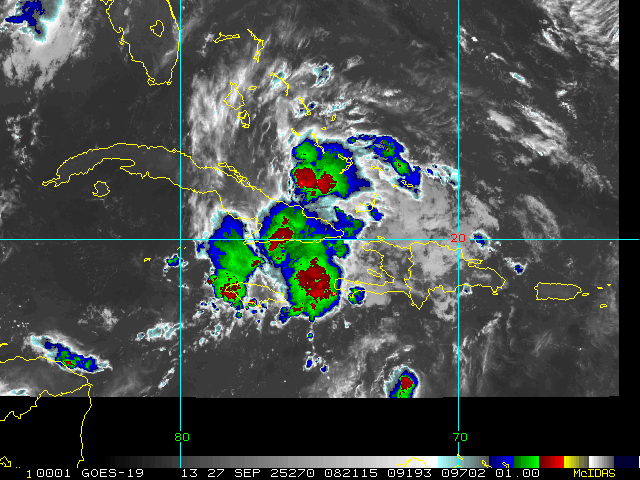
For PTC9 it may develop later today, and the official forecast stall sit offshore of South Carolina. Tropical Storm Warnings are up for most of the Bahamas this weekend as it will pass through there. Dryer air in the Gulf will likely keep most of the convection and rain away from Florida as it passes by, as the storm doesn't have much on the west side, most areas in Florida won't see any rain from it. Beyond the Bahamas it's currently expected to stall offshore, but possibly close enough to South Carolina for some impacts there, and then head generally out to sea. There's is still a high degree of uncertainty, but that is currently the most likely. Everyone along the southeast and Bermuda should monitor this system, as things could change, especially if the system forms north of forecast or moves faster than forecast since it has not developed yet.
6:40PM EDT 26 September 2025 Update
Advisory packages are now out on NINE (Potential Tropical Cyclone formerly tracked as Invest 94L)
Quote:
Potential Tropical Cyclone Nine Advisory Number 1
NWS National Hurricane Center Miami FL AL092025
500 PM EDT Fri Sep 26 2025
...TROPICAL STORM WATCHES AND WARNINGS ISSUED FOR PORTIONS OF THE BAHAMAS...
WATCHES AND WARNINGS
--------------------
CHANGES WITH THIS ADVISORY:
The government of the Bahamas has issued a Tropical Storm Warning for the central Bahamas and a Tropical Storm Watch for portions of thenorthwestern Bahamas.
SUMMARY OF WATCHES AND WARNINGS IN EFFECT:
A Tropical Storm Warning is in effect for...
* Central Bahamas, including Cat Island, the Exumas, Long Island, Rum Cay, and San Salvador.
A Tropical Storm Watch is in effect for...
* Portions of the northwestern Bahamas, including Eleuthera, New Providence, the Abacos, Berry Islands, and Grand Bahama Island.
Ciel
Original Update
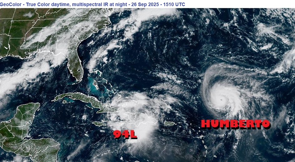
With echos of 2024, after a confounding long duration pause during the "peak" of the season that lulled many into complacency, the Atlantic basin is off to the races as we close out the month of September.
Hurricane Humberto is on the fast track to become a Major, our third of the year, and could accomplish this as soon as this afternoon. The updated NHC track has Bermuda in the Cone as well as potentially the Right Front Quadrant, where more often than not, the strongest weather occurs (wind, rain, flooding, surge, waterspouts, etc). There is a reasonable chance that Humberto reaches mid/high-end Saffir-Simpson Cat 4, and in fact, Cat 5 is not at all out of the question. In addition, Humberto has been growing larger, so impacts will likely be felt on the island regardless of whether or not there is a direct strike.
Invest 94L continues organizing and NHC Advisories could be coming out at any time whether or not a TC has yet formed, as tropical storm/hurricane conditions and storm surge could be coming to the Bahamas and Southeast US within 72 hours. While the ramp for Rapid Intensification does not look as easy for 94L as it appears to be for Humberto, 94L could also become a powerful hurricane. In addition, a PRE (Predecessor Rain Event) is setting up in states along the southeast and portions of the mid-Atlantic. Between the PRE and likely-Imelda-to-be, flooding may become widespread and potentially locally catastrophic. Interests in states such as Georgia, the Carolinas and Virginia may want to begin paying very close attention to official forecasts and warnings for 94L/Imelda, and take all prudent precautions.
Model deep dives and speculations in the Forecast Lounge:
Humberto Forecast Lounge
Imelda Forecast Lounge
Humberto Event Related Links
Tropical Tidbits Page on system
Flhurricane Satellite Floater Animation of Humberto
GOES Floater
Tomer Berg Info page for Humberto
CyclonicWx Page for Humberto
Clark Evans Track Model Plot of Humberto
(Animated!) Model Plots in Google Earth - In Google Maps
Clark Evans Intensity Model Plot of Humberto (Animated!)
Clark Evans Track Plot of Humberto
Clark Evans Top 10 Analog Storms for Humberto
http://www.ral.ucar.edu/guidance/realtime/current/ More model runs on from RAL/Jonathan Vigh's page
NRL Info on Humberto -- RAMMB Info
COD Atlantic Satellite View
Imelda Event Related Links
Tropical Tidbits Page on system
Flhurricane Satellite Floater Animation of Imelda
GOES Floater
Tomer Berg Info page for Imelda
CyclonicWx Page for Imelda
Clark Evans Track Model Plot of Imelda
(Animated!) Model Plots in Google Earth - In Google Maps
Clark Evans Intensity Model Plot of Imelda (Animated!)
Clark Evans Track Plot of Imelda
Clark Evans Top 10 Analog Storms for Imelda
http://www.ral.ucar.edu/guidance/realtime/current/ More model runs on from RAL/Jonathan Vigh's page
NRL Info on Imelda -- RAMMB Info
COD Atlantic Satellite View
Bermuda Newspapers/Media/Info:
Humberto is now a hurricane this morning and Bermuda is in the cone, however it is likely to stay west of Bermuda, although those there should keep an eye on it.
Invest 94L still has a 80/90% chance to develop, high level steering recon is out en force today, but the first low level standard one happens this afternoon. Advisories may start at any time today on this system. There still is quite a bit of uncertainty in regards to the track and intensity of 94L going forward because of how close Humberto is, but those along the southeast, particularly in South Carolina and North Carolina need to pay close attention.
12:30PM EDT 25 September 2025 Update
It is increasingly likely that NHC Advisories will begin on what should ultimately become Imelda, whether or not a TC has yet formed. This is because models are now strongly advertising development with impacts on land (Bahamas, specifically) within the next 72 hours. In fact, tropical storm conditions could arrive within just the next 48 hours. Interests in the Bahamas may already want to be making initial preparations for the arrival of tropical cyclone conditions over the weekend that could continue into early next week.
Updated Issuance Criteria for Potential Tropical Cyclone Advisory
Quote:
The National Hurricane Center (NHC), the Central Pacific Hurricane Center (CPHC), and the National Weather Service (NWS) have updated the issuance criteria for tropical cyclone advisory products for Potential Tropical Cyclones. A Potential Tropical Cyclone (PTC) is a disturbance that is not yet a tropical cyclone but poses the threat of bringing tropical storm or hurricane conditions to land areas. With the change, the NHC and CPHC will have the ability to issue tropical cyclone advisory products up to 72 hours before the anticipated arrival of storm surge or tropical-storm-force winds on land regardless of the immediate need for land-based tropical storm, hurricane, or storm surge watches or warnings. Previously, NHC and CPHC could only begin issuing advisory products for PTCs that required land-based watches (issued 48 hours in advance of conditions beginning) or warnings (issued 36 hours in advance of conditions beginning). This change gives NHC and CPHC the option to issue these advisory products at longer lead times when confidence is high that there is a significant risk of wind and storm surge impacts to land areas. Tropical cyclone advisory products for PTCs include all storm-specific text and graphical products routinely issued by NHC and CPHC each advisory cycle (i.e., 0300, 0900, 1500, and 2100 Coordinated Universal Time (UTC)), such as the Tropical Cyclone Public Advisory (TCP) and the Cone Graphic.
Ciel
8:00AM EDT 25 September 2025 Update
Invest 93L became Tropical Storm Humberto yesterday and is now officially forecast to become a Major by Monday. Interests in Bermuda may want to watch it closely, as while presently outside of the cone, NHC track error margins this far out can be significant.
Invest 94L now has NHC 90% chances of developing this week and 70% within just the next 48 hours. Models strongly suggest that the US could be in play. This disturbance bears very close watching for everyone from the Bahamas up through Florida and the entire southeast. Advisories could be coming soon even if a depression has not yet formed. Recon is aggressively flying and sampling the environment in and around 94L, and this invaluable data will help improve the forecasts going forward.
Way out in the northeastern subtropical Atlantic, a wind max associated with Hurricane Gabrielle could really do a number on the Azores overnight tonight into Friday, and interests there should be rushing preparations to completion for a very strong Cat 1 hurricane that could come in causing more damage than that of a typical Cat 1.
The concerns about a potentially active back half of the season are verifying.
Ciel
9:30PM EDT 23 September 2025 Update
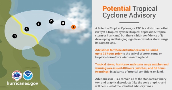
Conditions for development of both Invests 93L and 94L continue improving, and given their close proximity to land and the updated 2025 NHC policy allowing advisories to be issued on Potential Tropical Cyclones, "PTCs," up to 72 hours before the anticipated arrival of storm surge or tropical-storm-force winds on land whether or not a bona fide TC has yet formed, official NHC advisories, possibly even watches and/or warnings, could be coming within the next 24 hours, even as quickly as by tomorrow morning.
Forecasting the tracks and intensities of both Invest 93L and 94L is very challenging, even for the best computer models and most seasoned hurricane experts. More competing and interacting influences than normal, not the least of which could be their proximity to one another, will likely result in any initial forecasts and advisories being of lower confidence than usual.
More than a half dozen recon flights have already been scheduled for 94L, which is the disturbance closest to land. Flights will almost certainly get added soon for 93L, as well.
Ciel
12:00PM EDT 23 September 2025 Update
A Hurricane Watch is now in place for all of the Azores in the northeastern Subtropical Atlantic with Gabrielle. Strong Cat 1/2 hurricane conditions are increasingly likely across the islands late Thursday into early Friday. Interests in the Azores islands should begin taking hurricane preparations as conditions are forecast to deteriorate rapidly within the next 48 hours.
Soon after passing through the Azores, strong post-tropical/hybrid storm conditions are increasingly possible in Spain and Portugal over the coming weekend into Monday with damaging winds and heavy surf.
Much closer to home, model runs continue heating up on newly Invest-tagged 93L and 94L, with a few notable exceptions. Conditions for development in the Atlantic basin are orders of magnitude improved over just a few weeks ago and it would not be surprising to see both get named. The next names on the list in the Atlantic this year are Humberto and Imelda.
Deeper model dives and speculation on all three of these can be found in the Forecast Lounge Forum:
Invest 93L Forecast Lounge
Invest 94L Forecast Lounge
Hurricane Gabrielle Forecast Lounge
Quote:
The Azores Meteorological Service has issued a Hurricane Watch for all the islands of the Azores.
SUMMARY OF WATCHES AND WARNINGS IN EFFECT:
A Hurricane Watch is in effect for ... All of the Azores
Ciel
1:00PM EDT 22 September 2025 Update
Gabrielle became our second Major of the year while comfortably southeast of Bermuda.
Recon missions are presently sampling the very well-developed hurricane and finding that an eyewall replacement cycle could be starting, but for now, weakening has not commenced. Once the ERC has completed, it is possible that the hurricane's windfield is larger, with its upper-bound on the Saffir-Simpson scale a bit restricted as a trade-off. Given the potential for a larger Gabrielle, interests in the Azores may want to begin paying more attention, as hurricane conditions there could occur in less than 72 hours.
Elsewhere, three other areas of interest are on our radar. More on these to come.
Ciel
10:00AM EDT 17 September 2025 Update
Invest 92L became designated TD 7 early this morning. SEVEN is a very sloppy depression, and there may even be an argument that it remains more of a trof than one would like to see in a designated TC.
Initial runs on 92L pegged the disturbance around 13N, with NHC initial positioning of SEVEN at 13.7N. The system tracked as SEVEN now appears to be closer to 19N, based on conventional satellite imagery. Models and forecasts of SEVEN should be taken with a large helping of salt until there is more clarity. "TD 7" could have made a jump into the northern portion of the trof axis.
More on this in the Gabrielle Lounge
Ciel
Original Update
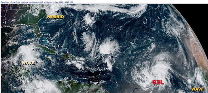
After a peak-season hibernation the likes of which have not been seen since 1939, the Atlantic basin is waking back up.
Basin-wide conditions for development are improving this week. A positive pulse from the MJO along with a climatologically consistent trend towards greater instability overall as we head into fall will conspire to enhance thunderstorm activity. Higher pressure in the subtropics appears set to weaken and/or shove away some of the TUTTs that have imparted high levels of shear and dry air over the past month. Meanwhile, the waves keep rolling off of Africa.
One of the waves to recently exit Africa is now on the cusp of becoming our next TD. This disturbance, Invest 92L, has potential to become a long-track Cape Verde-type storm, provided the basin does perform this week as forecast. Several models give 92L decent odds to become a powerful hurricane. Fortunately, very few models take it towards land, but at a minimum, Bermuda should watch.
Behind 92L another wave appears to have a good shot at development. This one is not yet Invest tagged.
Closer to home, a hybrid coastal storm off the coast of NC/VA remains too attached to its parent fronts and is under too much shear to have much more than maybe a 2% chance at a name, but those right along the coasts in this region probably agree that it "feels" like something with a name. This is expected to weaken today and track out to sea.
Gabrielle Event Related Links
Tropical Tidbits Page on system
Flhurricane Satellite Floater Animation of Gabrielle
GOES Floater
Tomer Berg Info page for Gabrielle
CyclonicWx Page for Gabrielle
Clark Evans Track Model Plot of Gabrielle
(Animated!) Model Plots in Google Earth - In Google Maps
Clark Evans Intensity Model Plot of Gabrielle (Animated!)
Clark Evans Track Plot of Gabrielle
Clark Evans Top 10 Analog Storms for Gabrielle
http://www.ral.ucar.edu/guidance/realtime/current/ More model runs on from RAL/Jonathan Vigh's page
NRL Info on Gabrielle -- RAMMB Info
COD Atlantic Satellite View
Humberto Event Related Links
Tropical Tidbits Page on system
Flhurricane Satellite Floater Animation of Humberto
GOES Floater
Tomer Berg Info page for Humberto
CyclonicWx Page for Humberto
Clark Evans Track Model Plot of Humberto
(Animated!) Model Plots in Google Earth - In Google Maps
Clark Evans Intensity Model Plot of Humberto (Animated!)
Clark Evans Track Plot of Humberto
Clark Evans Top 10 Analog Storms for Humberto
http://www.ral.ucar.edu/guidance/realtime/current/ More model runs on from RAL/Jonathan Vigh's page
NRL Info on Humberto -- RAMMB Info
COD Atlantic Satellite View
Invest 94L Event Related Links
Tropical Tidbits Page on system
Flhurricane Satellite Floater Animation of 94L
GOES Floater
Tomer Berg Info page for 94L
CyclonicWx Page for 94L
Clark Evans Track Model Plot of 94L
(Animated!) Model Plots in Google Earth - In Google Maps
Clark Evans Intensity Model Plot of 94L (Animated!)
Clark Evans Top 10 Analog Storms for 94L
http://www.ral.ucar.edu/guidance/realtime/current/ More model runs on from RAL/Jonathan Vigh's page
NRL Info on 94L -- RAMMB Info
COD Atlantic Satellite View
Coastal South Carolina Media:
94.3 WSC Charleston News Radio
Power Outage Map: South Carolina Power Outage Map
Bermuda Newspapers/Media/Info:

