cieldumort
Moderator

Reged:
Posts: 2900
Loc: Austin, Tx
|
|
A roughly eight day window for development in the Gulf is starting to get a lot more hits from extended range quality models and their ensembles. It is not immediately clear if this will be from a Central American Gyre, wave, or combination of both, but the general region of projected best genesis potential seems to favor either or both. The signal has been consistent, with the stellar Google DeepMind FNv3 now implying 40% odds of development from the western Caribbean into the Gulf during this window. Given the very consistent signal, we are starting a Lounge on this projected system, Invest TBD, at this time.
It is worth noting that 2026 has not seen a hurricane form yet in the Atlantic basin and the current El Niño has been much stronger than forecasts prior to the start of the season. In fact, this El Niño is setting all-time records going back at least decades and likely centuries. Given that we do not have much historical precedent to work off of as far as how this could influence modeling this far out, some consideration should be given that they could be overcooking things. Nonetheless, here are some examples:
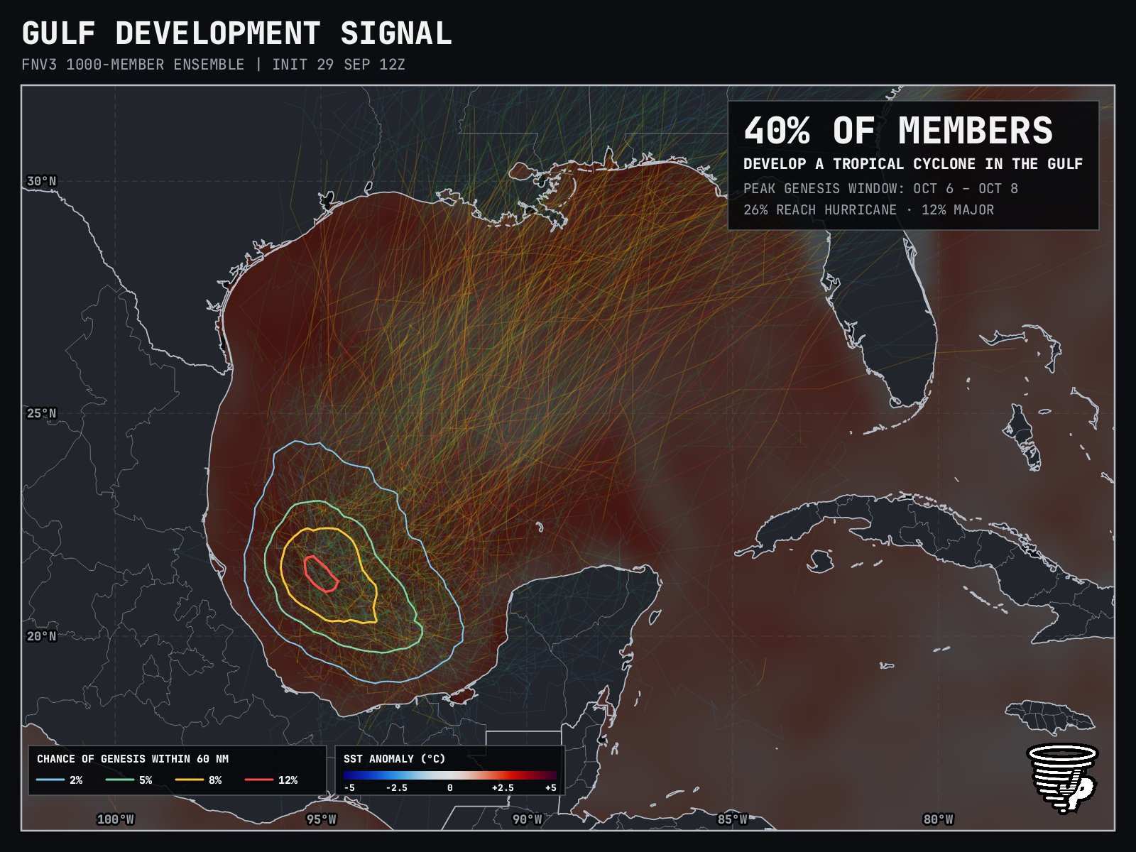
Image credit: James Pettus @PettusWX pettusplots.com
The most recent DeepMind generation, WNv3, is not as impressed, at 22% development odds. Timeline is about the same, with median genesis 228 hours from 12Z today (0z Oct 9)
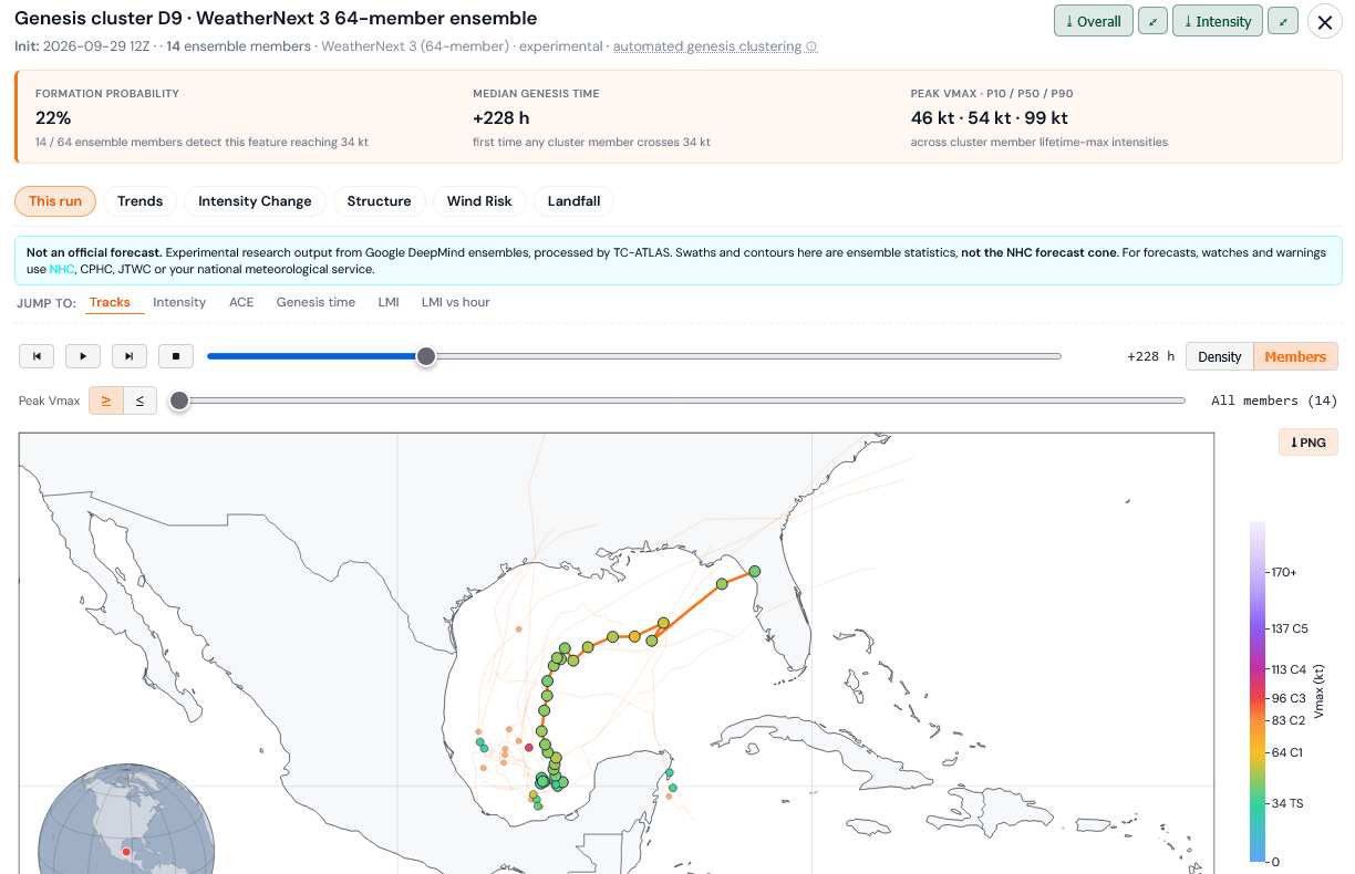
Credit: TC-ATLAS
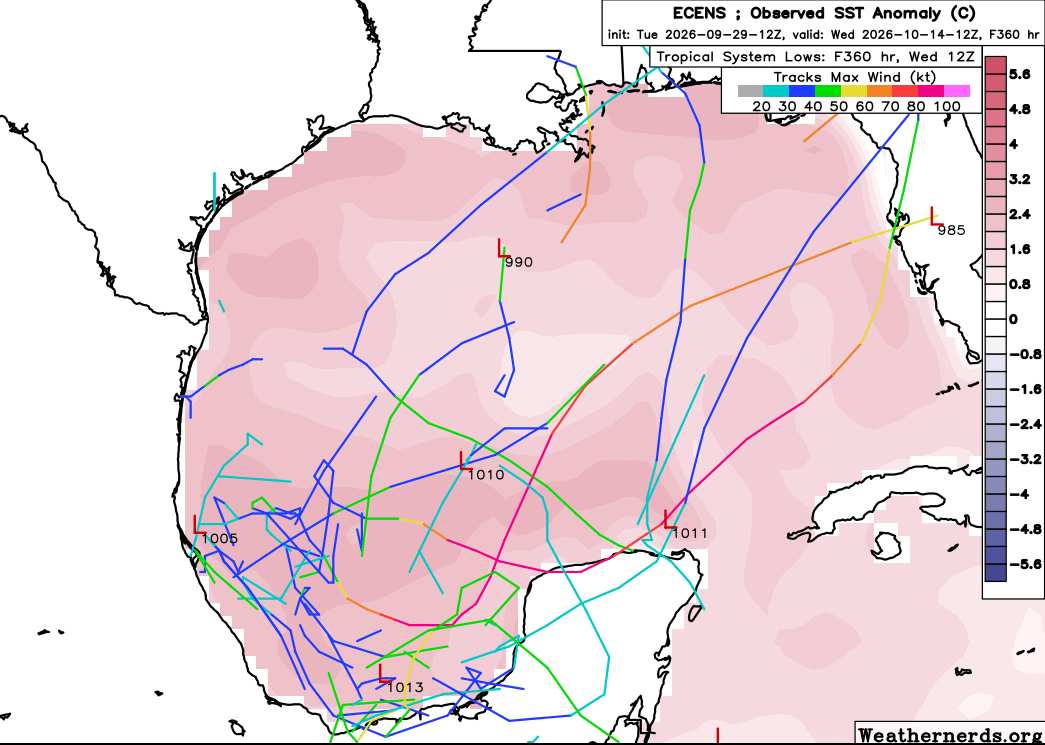
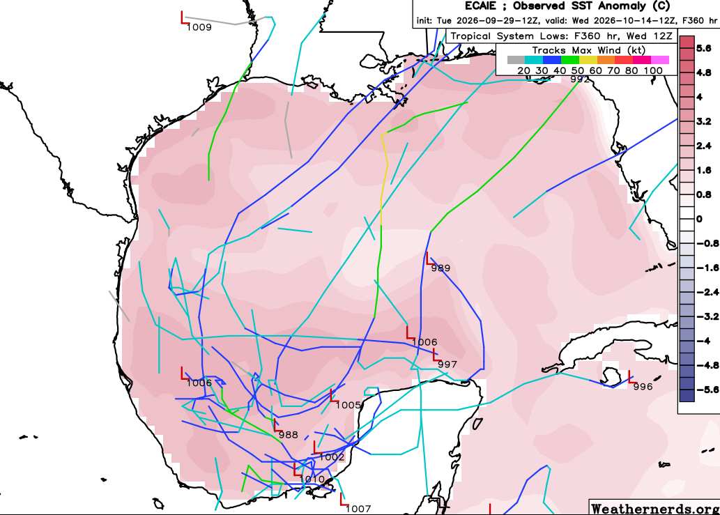
|
cieldumort
Moderator
Reged:
Posts: 2900
Loc: Austin, Tx
|
|
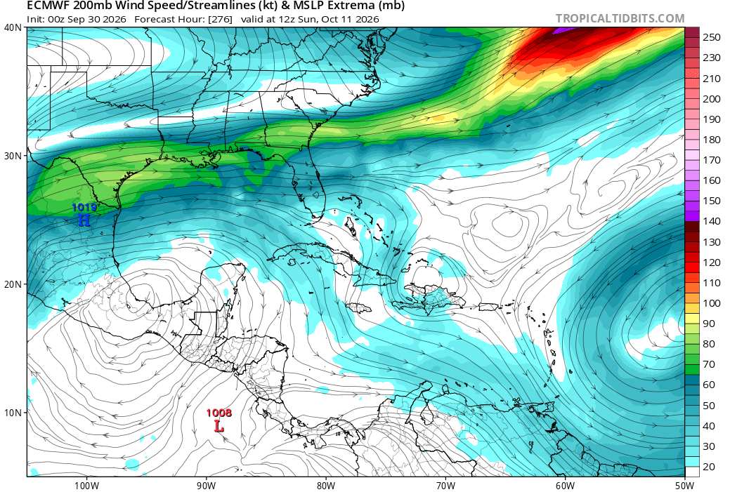
In general, this window favors development from all the usual suspects in and around the Gulf. However, anything that might want to form from a front in the northern Gulf could just trend more subtropical or at the very least sheared/struggling, while anything that might want to form in the Bay of Campeche (Central American Gyre-born/EPac crossover/tropical wave) looks to have much better odds of being purely tropical with potentially a higher intensity ceiling. Upper level winds/lift forecast to become quite favorable over the BOC during the middle of this window, as can be seen below.
|
cieldumort
Moderator
Reged:
Posts: 2900
Loc: Austin, Tx
|
|
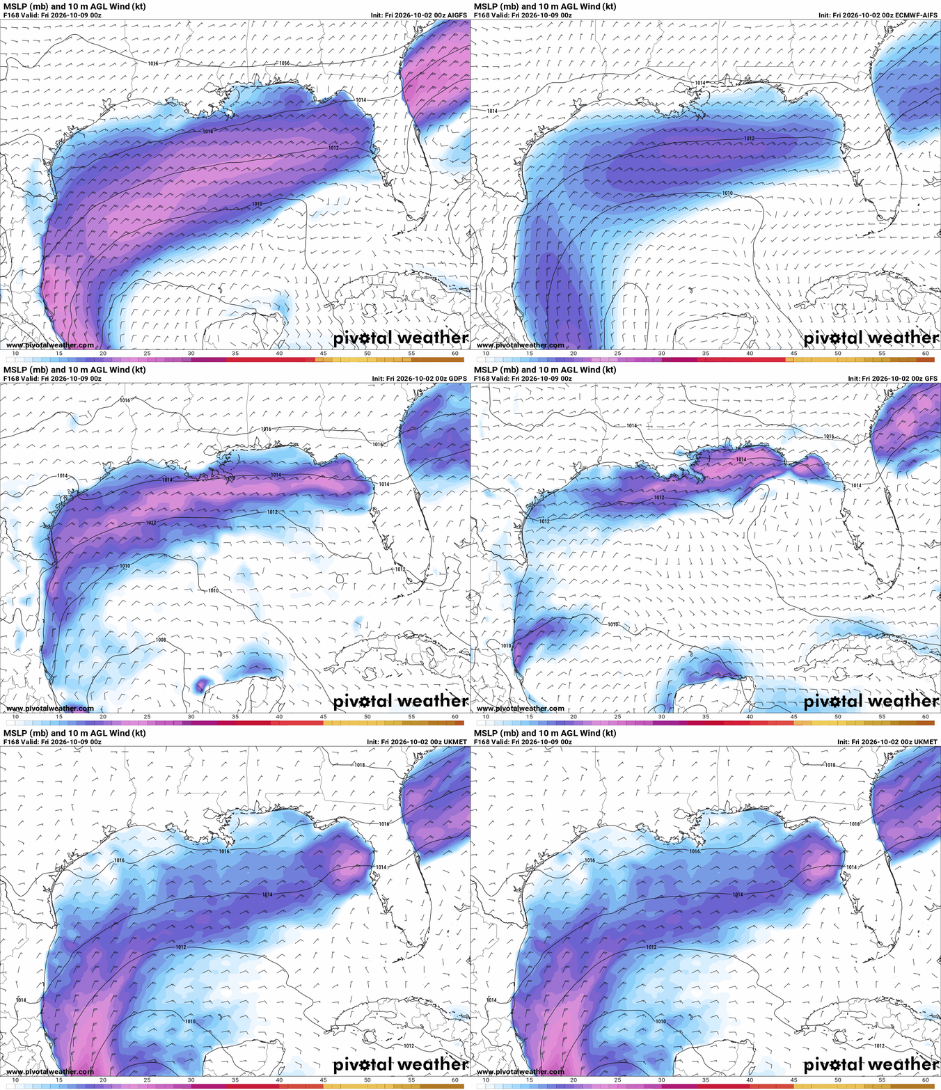
Out to 168 from 0z today, most Globals now advertise at least weak cyclonic surface flow in the Gulf, predominately around the Bay of Campeche-Yucatan Peninsula, save the ICON.
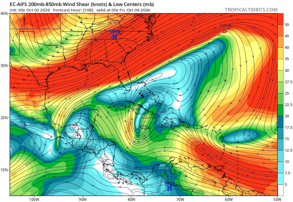
However, shear at this time could be prohibitive
|
cieldumort
Moderator
Reged:
Posts: 2900
Loc: Austin, Tx
|
|
Globals that are at least lukewarm to the idea of some kind of development in the Gulf during this window continue favoring a CAG and/or crossover method. While there are a few runs that tease something in the northern Gulf or even the east coast of Florida, those appear to be non-tropical lows, or subtropical at best, getting mistaken for tropical.
Taking a look at today's runs that do show development potential in the western Gulf, most only support a weaker and quicker storm, which makes sense with forecasts of ongoing high levels of shear. One caveat to the shear forecast, is that a good deal of the shear models see during this otherwise so-so window is a result of and possibly contingent on the development of yet another far east Pac tropical cyclone (as seen below shown to be an 80% region to the southeast of Hurricane Rachel in the )
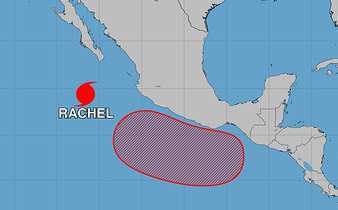
Should the Area of Interest presently southeast of Rachel not track close to mainland Mexico as forecast, shear across the Gulf could be less. Another wild card would be for this AOI to cross over into the BOC. A few models and/or ensembles suggest either as possible.
Some quick glances at a few of today's Globals
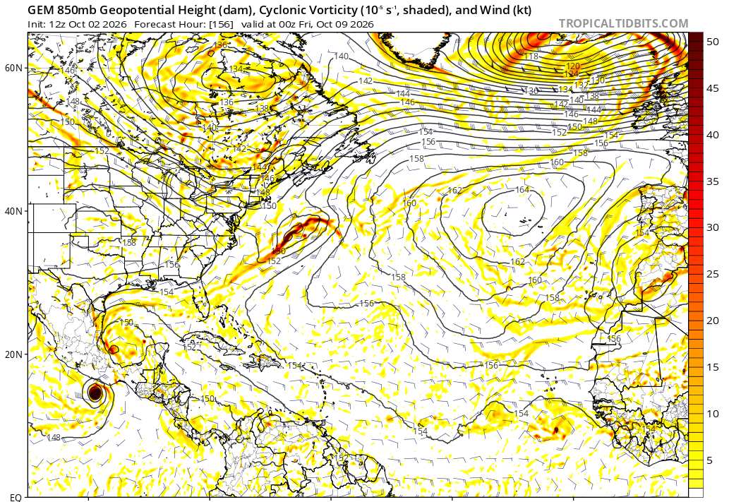
CANADIAN out to 156 hours advertising development on both sides of Central America (the previously noted AOI in the east Pac as well as a new disturbance in the BoC)
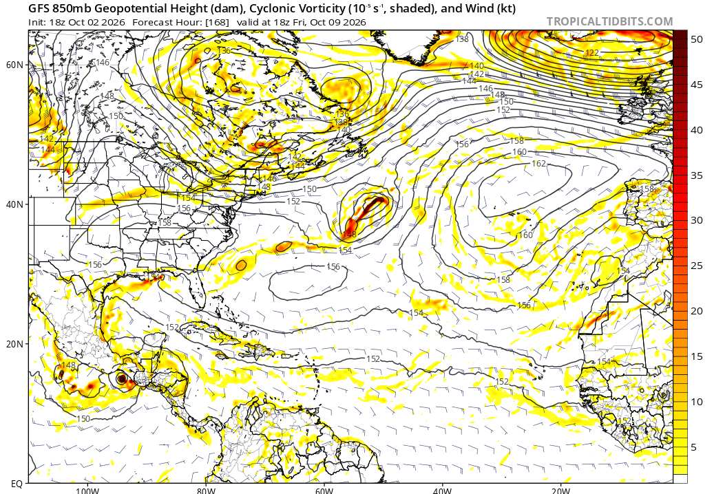
GFS takes the east Pac AOI itself across the Isthmus of Tehuantepec and creates a trof in the western Gulf, but without much development there. Rain-maker for east TX.
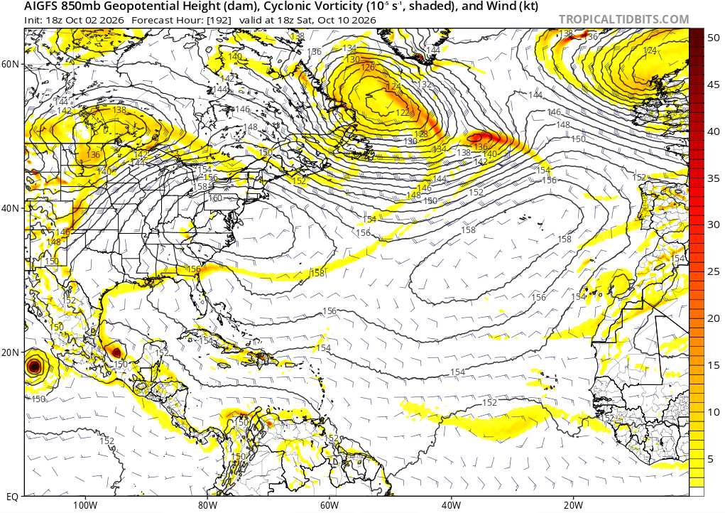
The AI makes like the Canadian and spawns two systems on either side of Central America, but the Gulf feature is kept weak, short-lived and runs into Mexico.
The window is still open, but this is a window with a lot of doubts, and if anything does form, unlike a lot of the hype seen in social media, odds are really that it would be weak and/or short-lived, with only an outlier chance of a strong cyclone (maybe at best 10-15% of something below 995mb IMHO)
|
cieldumort
Moderator
Reged:
Posts: 2900
Loc: Austin, Tx
|
|
This is an incredibly tricky season for both models and forecasters alike where the Atlantic basin is concerned. The one safe bet all season would have been, has been, should have been, "Nothing becomes a hurricane." Fay and possibly Edouard got close, but no cigar*. With this backdrop, the rational thing to do is ignore any model runs that ramp up this yet-to-form system in the Gulf beyond 60 MPH unless and until something is getting obvious.
The most recent suite of 0z Globals during this window.
Quick Globals rundown:
EURO - Sloppy Trof; borderline TD at times by 10/11/06z in northern Gulf
EURO AI - Weak Tropical Low by 10/11/0z in northwestern Gulf
GFS - TD or Low-end Trop Storm by 10/12/06z in northwestern Gulf
GFS AI - TD by 10/11/0z in the southwestern Gulf. Quickly makes landfall in western BOC mainland MX.
ICON - Borderline TD by 10/10/06z in the northern Gulf.
UKMET - Apparent TD or weak Trop Storm in the southwestern Gulf by 10/07/21z. Making landfall around Cape San Blas, Gulf County, 10/10/0z 989mb.
As for the Google DeepMind FNv3 ensembles, after a dip with their 18Z run, the most recent 0z came back in implying a 30% chance of this becoming a Tropical Storm
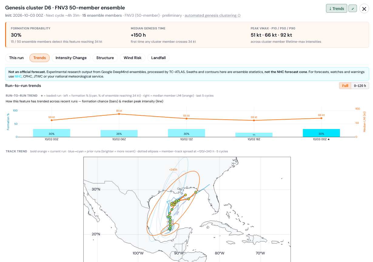
Credits: TC-ATLAS and Google
*Both Fay and Edouard were likely stronger than operational advisories had them and one or both could easily be upgraded during reanalysis. Only referring to real-time Advisories.
|
cieldumort
Moderator
Reged:
Posts: 2900
Loc: Austin, Tx
|
|
Here are the results of some 12Z Globals out today. Showing just TC genesis as "YES" or "NO" going out to 240 hours (10 days from today) and the date of apparent TC formation
EURO: NO
EURO AI: NO
GFS: YES Oct 8
GFS AI: YES Oct 10
CANADIAN: YES Oct 10
ICON: YES Oct 8
UKMET: YES Oct 8
|



 Previous
 Index
Index
 Next
Next
 Threaded


 Edit
Edit
 Reply
Reply
 Quote
Quote


