New Article: CSU releases 2026 season numbers, slightly below average. https://flhurricane.com
Days since last Hurricane Landfall —
US Any:
555 (Milton),
US Major:
555 (Milton),
FL Any:
555 (Milton),
FL Major:
555 (Milton)
cieldumort
Moderator

Reged:
Posts: 2664
Loc: Austin, Tx
|
|

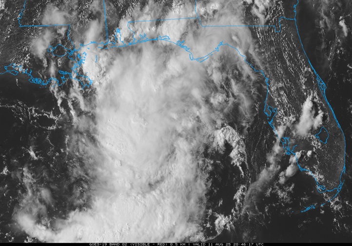
Above: NE Gulf Low Visible 8/11/25/2046z
An area of low pressure off the west coast of Florida we have been paying attention to has consolidated more, and as of this morning had become a somewhat well-defined low with winds up to gale-force in spots. While not yet Invest tagged, did add it to their 2PM this afternoon with a "Near Zero" odds of development.
It appears that operational models haven't been handling this system very well. ensembles OTOH have been suggesting something like a 33-45% chance of it becoming a TD early this week before coming ashore in north Florida.
Given the markedly improved structure today and the fact that it is already producing some serious flooding inland, we are starting a Lounge on this feature regardless of whether it is Invest tagged or not.
Interests in the northeast Gulf may want to pay closer attention given the pockets of strong wind and very heavy thunderstorms, and those along the coast and inland may want to have a ready source of weather watches and warnings given how much rain has already fallen and could continue to fall so long as this low is in the region.
Edited by cieldumort (Fri Aug 15 2025 03:26 PM)
|
cieldumort
Moderator

Reged:
Posts: 2664
Loc: Austin, Tx
|
|

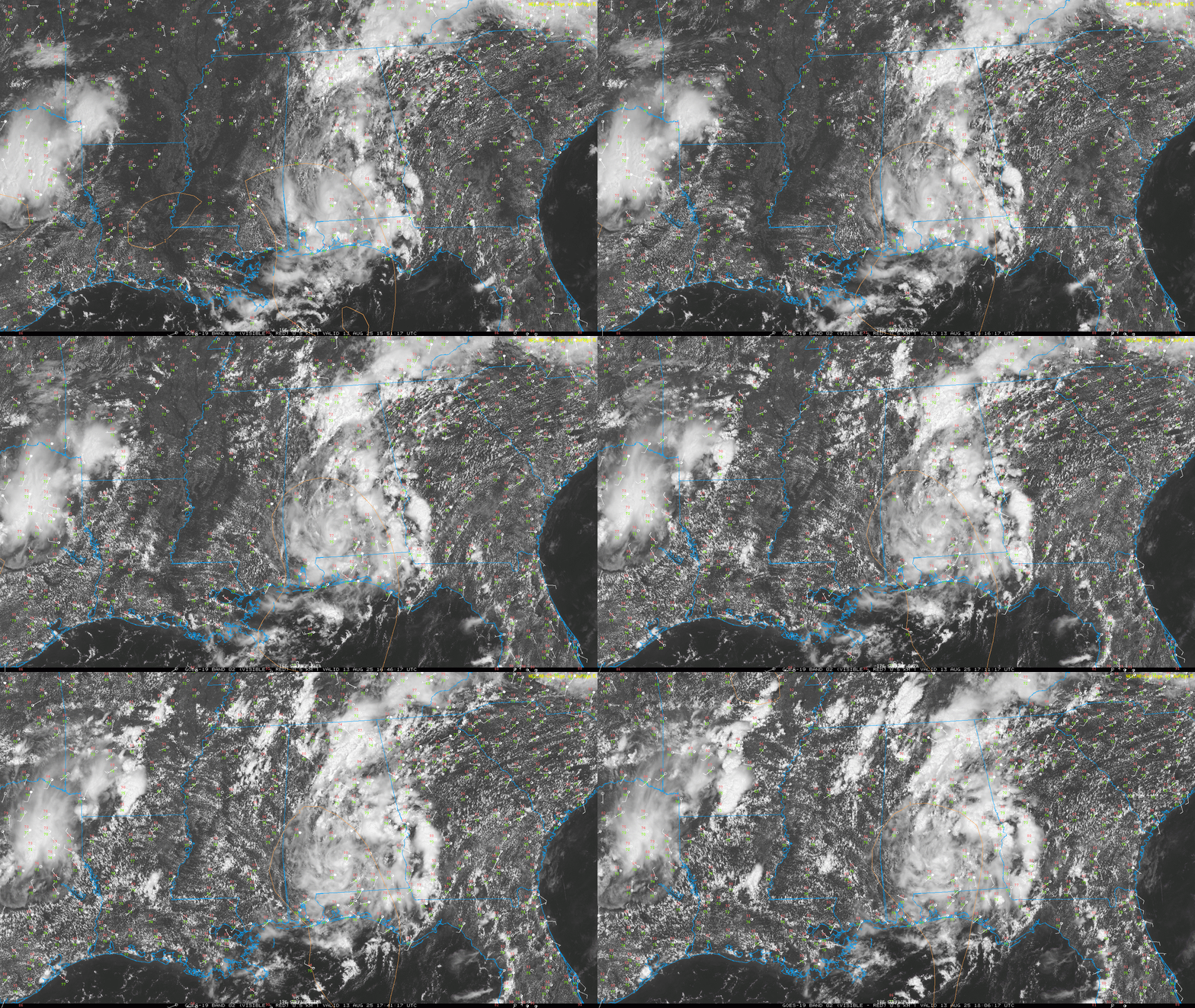
The low is now inland, pushing northeast of Mobile, AL with a coherent circulation from the surface to the 500mb level, and pulling up copious tropical moisture from out of the Gulf into areas in and around central and northern Alabama, northern Georgia, middle and eastern Tennessee, and eastern Kentucky, with many Flash Flood Watches up into Thursday.
|
cieldumort
Moderator

Reged:
Posts: 2664
Loc: Austin, Tx
|
|
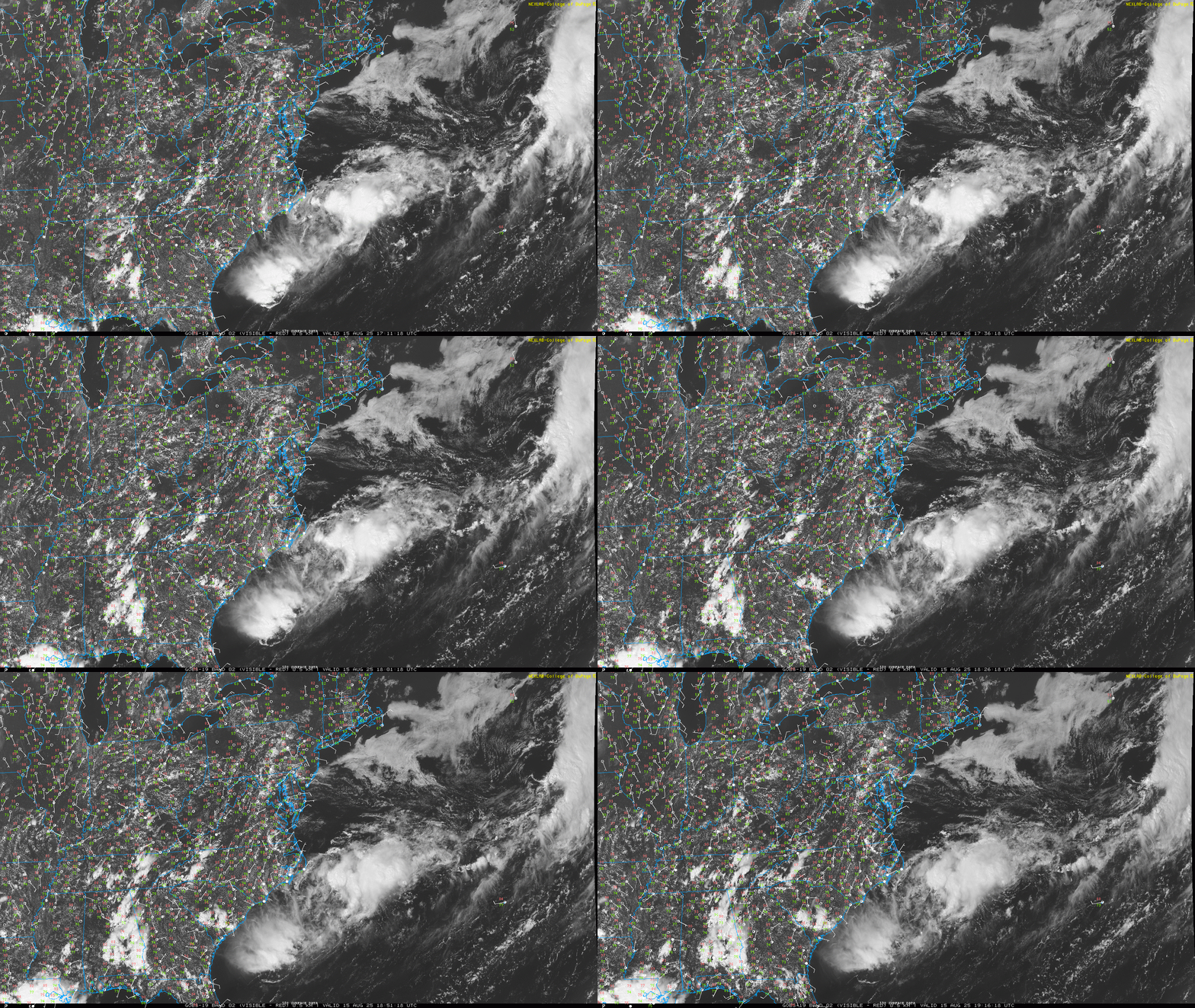
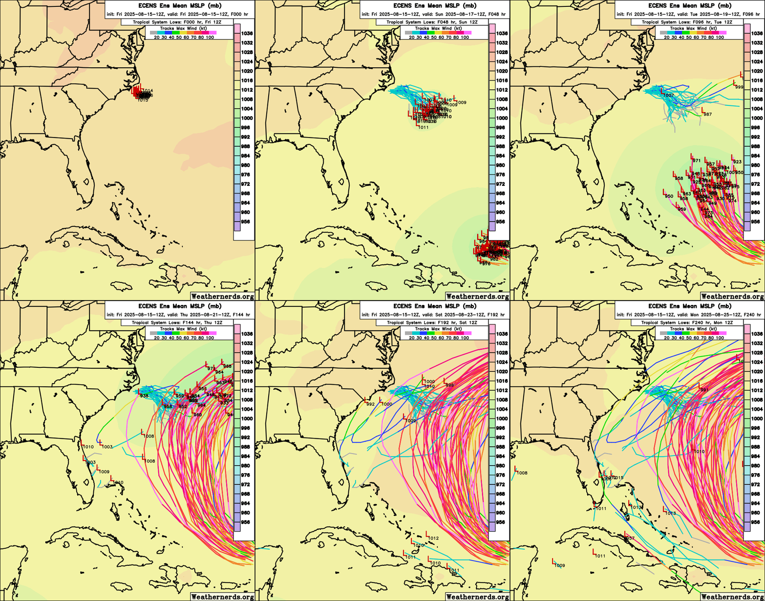
This area of low pressure has now moved offshore of the Carolinas and will likely aid in deflecting Erin from striking the United States as it helps create a weakness where high pressure has a hard time to build back in.

|
cieldumort
Moderator

Reged:
Posts: 2664
Loc: Austin, Tx
|
|

|
|
0 registered and 12 anonymous users are browsing this forum.
Moderator:
Print Topic
|
Forum Permissions
You cannot start new topics
You cannot reply to topics
HTML is disabled
UBBCode is enabled
|
Rating:
Topic views: 5022
|
|
|
|
|
|
Note: This is
NOT an official page. It is run by weather hobbyists and should not be used as a replacement for official sources.
CFHC's main servers are currently located at
Hostdime.com in Orlando, FL.
Image Server Network thanks to Mike Potts and Amazon Web Services. If you have static file hosting space that allows dns aliasing contact us to help out! Some Maps Provided by:
Great thanks to all who
donated and everyone who uses the site as well.
Site designed for 800x600+ resolution
When in doubt, take the word of the
National Hurricane Center
G